You are here: Home > Network List > TA - USArray Transportable Network (new EarthScope stations) Stations List
> Station N28A Pribbeno Ranch, Imperial, NE, USA > Earthquake Result Viewer
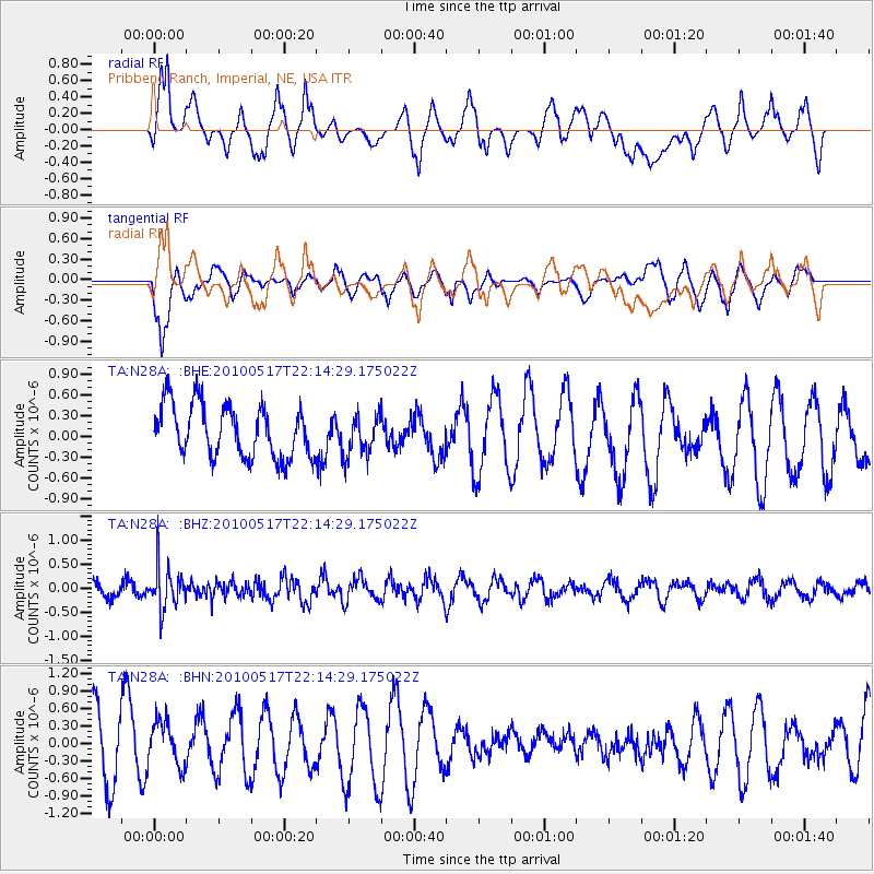
N28A Pribbeno Ranch, Imperial, NE, USA - Earthquake Result Viewer
*The percent match for this event was below the threshold and hence no stack was calculated.
| Earthquake location: |
Kuril Islands |
| Earthquake latitude/longitude: |
46.3/152.0 |
| Earthquake time(UTC): |
2010/05/17 (137) 22:03:47 GMT |
| Earthquake Depth: |
73 km |
| Earthquake Magnitude: |
5.7 MB, 5.3 MW |
| Earthquake Catalog/Contributor: |
WHDF/NEIC |
|
| Network: |
TA USArray Transportable Network (new EarthScope stations) |
| Station: |
N28A Pribbeno Ranch, Imperial, NE, USA |
| Lat/Lon: |
40.69 N/101.54 W |
| Elevation: |
1009 m |
|
| Distance: |
71.4 deg |
| Az: |
50.304 deg |
| Baz: |
315.441 deg |
| Ray Param: |
$rayparam |
*The percent match for this event was below the threshold and hence was not used in the summary stack. |
|
| Radial Match: |
68.86331 % |
| Radial Bump: |
400 |
| Transverse Match: |
55.049374 % |
| Transverse Bump: |
360 |
| SOD ConfigId: |
314592 |
| Insert Time: |
2010-09-04 06:57:35.776 +0000 |
| GWidth: |
2.5 |
| Max Bumps: |
400 |
| Tol: |
0.001 |
|
Signal To Noise
| Channel | StoN | STA | LTA |
| TA:N28A: :BHZ:20100517T22:14:29.175022Z | 3.1699781 | 4.4681653E-7 | 1.4095257E-7 |
| TA:N28A: :BHN:20100517T22:14:29.175022Z | 0.6880277 | 3.9630103E-7 | 5.759958E-7 |
| TA:N28A: :BHE:20100517T22:14:29.175022Z | 0.76773983 | 2.9085462E-7 | 3.788453E-7 |
| Arrivals |
| Ps | |
| PpPs | |
| PsPs/PpSs | |


