You are here: Home > Network List > TA - USArray Transportable Network (new EarthScope stations) Stations List
> Station A29A Manning Farm, Rocklake, ND, USA > Earthquake Result Viewer
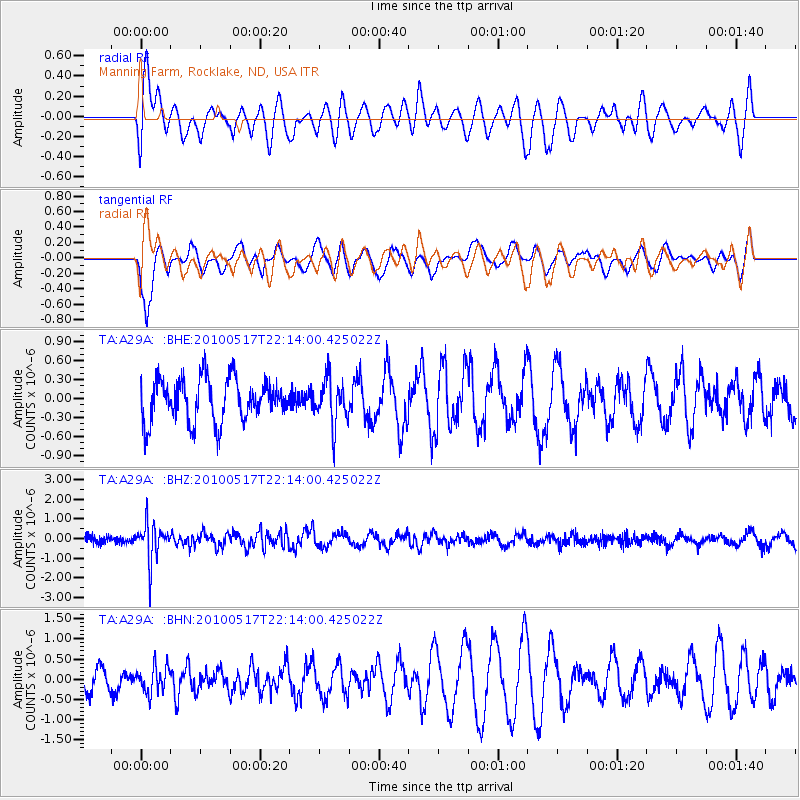
A29A Manning Farm, Rocklake, ND, USA - Earthquake Result Viewer
*The percent match for this event was below the threshold and hence no stack was calculated.
| Earthquake location: |
Kuril Islands |
| Earthquake latitude/longitude: |
46.3/152.0 |
| Earthquake time(UTC): |
2010/05/17 (137) 22:03:47 GMT |
| Earthquake Depth: |
73 km |
| Earthquake Magnitude: |
5.7 MB, 5.3 MW |
| Earthquake Catalog/Contributor: |
WHDF/NEIC |
|
| Network: |
TA USArray Transportable Network (new EarthScope stations) |
| Station: |
A29A Manning Farm, Rocklake, ND, USA |
| Lat/Lon: |
48.92 N/99.23 W |
| Elevation: |
480 m |
|
| Distance: |
66.8 deg |
| Az: |
42.82 deg |
| Baz: |
314.391 deg |
| Ray Param: |
$rayparam |
*The percent match for this event was below the threshold and hence was not used in the summary stack. |
|
| Radial Match: |
49.128555 % |
| Radial Bump: |
400 |
| Transverse Match: |
71.84362 % |
| Transverse Bump: |
386 |
| SOD ConfigId: |
314592 |
| Insert Time: |
2010-09-04 07:01:08.340 +0000 |
| GWidth: |
2.5 |
| Max Bumps: |
400 |
| Tol: |
0.001 |
|
Signal To Noise
| Channel | StoN | STA | LTA |
| TA:A29A: :BHZ:20100517T22:14:00.425022Z | 5.960994 | 9.699207E-7 | 1.6271125E-7 |
| TA:A29A: :BHN:20100517T22:14:00.425022Z | 0.76236576 | 3.2031414E-7 | 4.201581E-7 |
| TA:A29A: :BHE:20100517T22:14:00.425022Z | 1.0655378 | 3.580302E-7 | 3.3600892E-7 |
| Arrivals |
| Ps | |
| PpPs | |
| PsPs/PpSs | |


