You are here: Home > Network List > TA - USArray Transportable Network (new EarthScope stations) Stations List
> Station F28A McLaughlin, SD, USA > Earthquake Result Viewer
F28A McLaughlin, SD, USA - Earthquake Result Viewer
*The percent match for this event was below the threshold and hence no stack was calculated.
| Earthquake location: |
Kuril Islands |
| Earthquake latitude/longitude: |
46.3/152.0 |
| Earthquake time(UTC): |
2010/05/17 (137) 22:03:47 GMT |
| Earthquake Depth: |
73 km |
| Earthquake Magnitude: |
5.7 MB, 5.3 MW |
| Earthquake Catalog/Contributor: |
WHDF/NEIC |
|
| Network: |
TA USArray Transportable Network (new EarthScope stations) |
| Station: |
F28A McLaughlin, SD, USA |
| Lat/Lon: |
45.85 N/100.80 W |
| Elevation: |
633 m |
|
| Distance: |
68.2 deg |
| Az: |
46.006 deg |
| Baz: |
314.461 deg |
| Ray Param: |
$rayparam |
*The percent match for this event was below the threshold and hence was not used in the summary stack. |
|
| Radial Match: |
40.469822 % |
| Radial Bump: |
400 |
| Transverse Match: |
62.61349 % |
| Transverse Bump: |
400 |
| SOD ConfigId: |
314592 |
| Insert Time: |
2010-09-04 07:01:21.104 +0000 |
| GWidth: |
2.5 |
| Max Bumps: |
400 |
| Tol: |
0.001 |
|
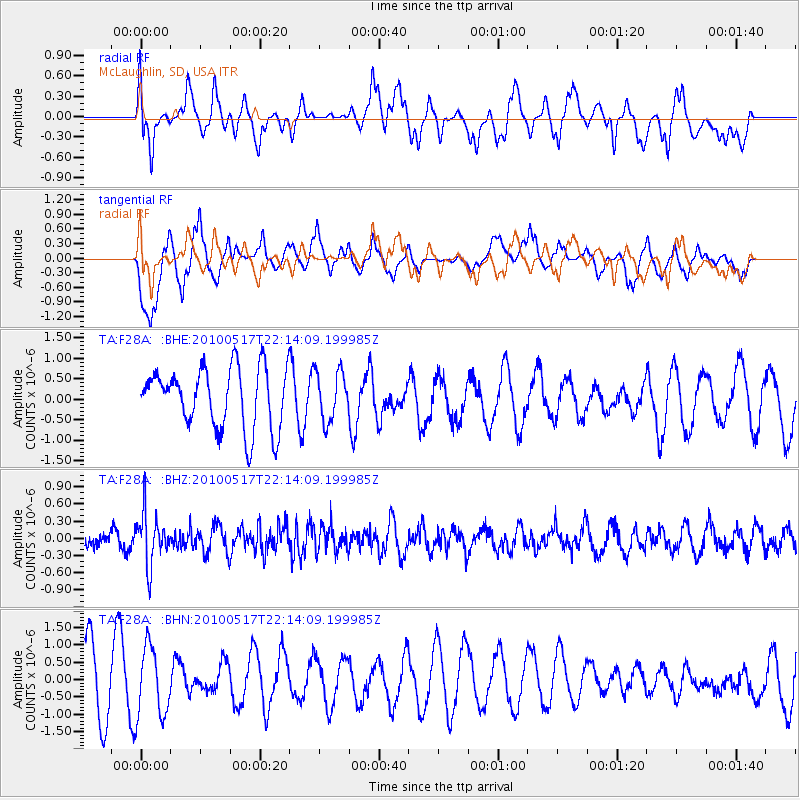
Signal To Noise
| Channel | StoN | STA | LTA |
| TA:F28A: :BHZ:20100517T22:14:09.199985Z | 3.8133576 | 4.5049427E-7 | 1.1813586E-7 |
| TA:F28A: :BHN:20100517T22:14:09.199985Z | 1.2216984 | 9.905816E-7 | 8.1082345E-7 |
| TA:F28A: :BHE:20100517T22:14:09.199985Z | 0.8050251 | 5.943067E-7 | 7.3824623E-7 |
| Arrivals |
| Ps | |
| PpPs | |
| PsPs/PpSs | |


