You are here: Home > Network List > IW - Intermountain West Stations List
> Station MOOW Moose Ponds, Wyoming, USA > Earthquake Result Viewer
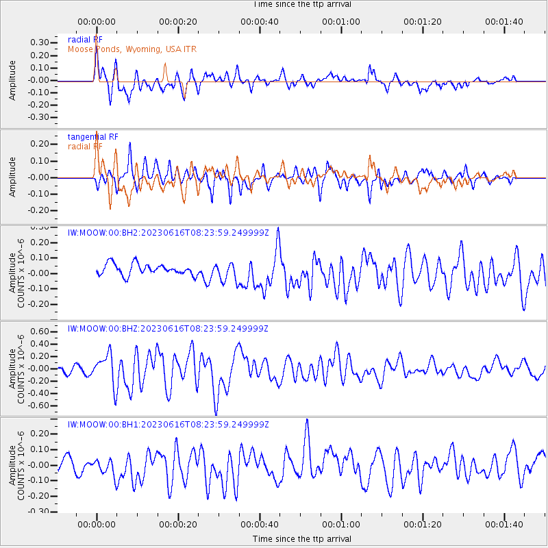
MOOW Moose Ponds, Wyoming, USA - Earthquake Result Viewer
*The percent match for this event was below the threshold and hence no stack was calculated.
| Earthquake location: |
Tonga Islands Region |
| Earthquake latitude/longitude: |
-23.6/-175.9 |
| Earthquake time(UTC): |
2023/06/16 (167) 08:11:34 GMT |
| Earthquake Depth: |
22 km |
| Earthquake Magnitude: |
6.0 mww |
| Earthquake Catalog/Contributor: |
NEIC PDE/us |
|
| Network: |
IW Intermountain West |
| Station: |
MOOW Moose Ponds, Wyoming, USA |
| Lat/Lon: |
43.75 N/110.74 W |
| Elevation: |
2128 m |
|
| Distance: |
89.7 deg |
| Az: |
41.112 deg |
| Baz: |
236.359 deg |
| Ray Param: |
$rayparam |
*The percent match for this event was below the threshold and hence was not used in the summary stack. |
|
| Radial Match: |
69.12142 % |
| Radial Bump: |
400 |
| Transverse Match: |
67.58286 % |
| Transverse Bump: |
400 |
| SOD ConfigId: |
30536071 |
| Insert Time: |
2023-06-30 08:28:27.418 +0000 |
| GWidth: |
2.5 |
| Max Bumps: |
400 |
| Tol: |
0.001 |
|
Signal To Noise
| Channel | StoN | STA | LTA |
| IW:MOOW:00:BHZ:20230616T08:23:59.249999Z | 3.6380389 | 2.568644E-7 | 7.060519E-8 |
| IW:MOOW:00:BH1:20230616T08:23:59.249999Z | 1.2126776 | 6.306117E-8 | 5.2001596E-8 |
| IW:MOOW:00:BH2:20230616T08:23:59.249999Z | 1.7048274 | 6.166917E-8 | 3.6173258E-8 |
| Arrivals |
| Ps | |
| PpPs | |
| PsPs/PpSs | |


