You are here: Home > Network List > TA - USArray Transportable Network (new EarthScope stations) Stations List
> Station 334A Lometa, TX, USA > Earthquake Result Viewer
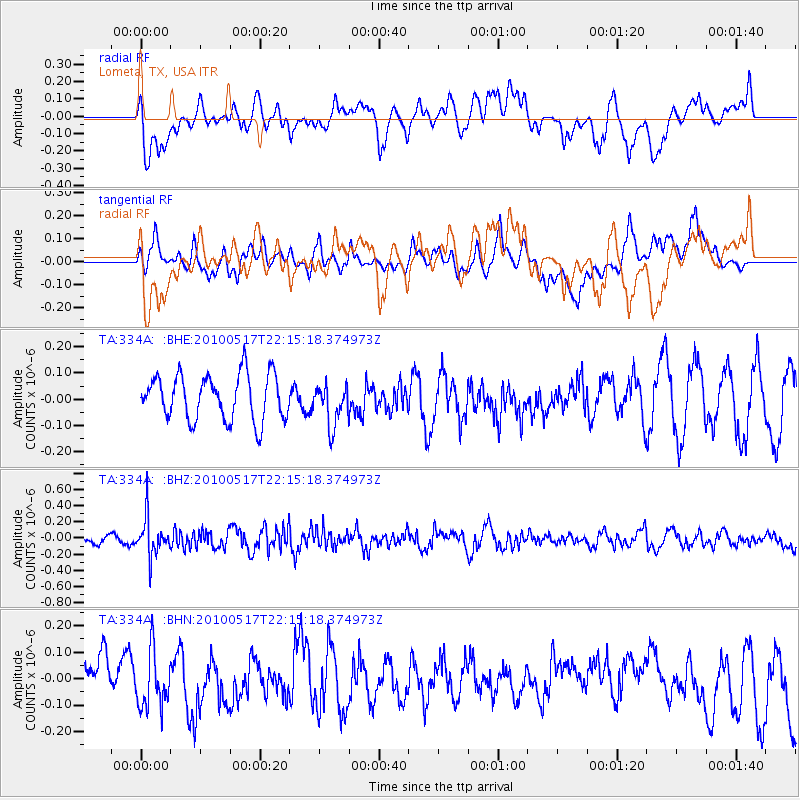
334A Lometa, TX, USA - Earthquake Result Viewer
*The percent match for this event was below the threshold and hence no stack was calculated.
| Earthquake location: |
Kuril Islands |
| Earthquake latitude/longitude: |
46.3/152.0 |
| Earthquake time(UTC): |
2010/05/17 (137) 22:03:47 GMT |
| Earthquake Depth: |
73 km |
| Earthquake Magnitude: |
5.7 MB, 5.3 MW |
| Earthquake Catalog/Contributor: |
WHDF/NEIC |
|
| Network: |
TA USArray Transportable Network (new EarthScope stations) |
| Station: |
334A Lometa, TX, USA |
| Lat/Lon: |
31.33 N/98.24 W |
| Elevation: |
389 m |
|
| Distance: |
80.1 deg |
| Az: |
54.848 deg |
| Baz: |
318.504 deg |
| Ray Param: |
$rayparam |
*The percent match for this event was below the threshold and hence was not used in the summary stack. |
|
| Radial Match: |
50.31031 % |
| Radial Bump: |
400 |
| Transverse Match: |
53.035698 % |
| Transverse Bump: |
400 |
| SOD ConfigId: |
314592 |
| Insert Time: |
2010-09-04 07:04:41.667 +0000 |
| GWidth: |
2.5 |
| Max Bumps: |
400 |
| Tol: |
0.001 |
|
Signal To Noise
| Channel | StoN | STA | LTA |
| TA:334A: :BHZ:20100517T22:15:18.374973Z | 3.632325 | 2.3872477E-7 | 6.5722304E-8 |
| TA:334A: :BHN:20100517T22:15:18.374973Z | 1.3205695 | 1.02826924E-7 | 7.7865586E-8 |
| TA:334A: :BHE:20100517T22:15:18.374973Z | 0.9456299 | 8.115771E-8 | 8.582396E-8 |
| Arrivals |
| Ps | |
| PpPs | |
| PsPs/PpSs | |


