You are here: Home > Network List > US - United States National Seismic Network Stations List
> Station EGMT Eagleton, Montana, USA > Earthquake Result Viewer
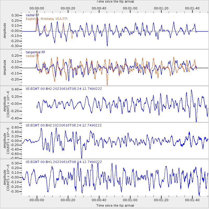
EGMT Eagleton, Montana, USA - Earthquake Result Viewer
*The percent match for this event was below the threshold and hence no stack was calculated.
| Earthquake location: |
Tonga Islands Region |
| Earthquake latitude/longitude: |
-23.6/-175.9 |
| Earthquake time(UTC): |
2023/06/16 (167) 08:11:34 GMT |
| Earthquake Depth: |
22 km |
| Earthquake Magnitude: |
6.0 mww |
| Earthquake Catalog/Contributor: |
NEIC PDE/us |
|
| Network: |
US United States National Seismic Network |
| Station: |
EGMT Eagleton, Montana, USA |
| Lat/Lon: |
48.02 N/109.75 W |
| Elevation: |
1055 m |
|
| Distance: |
92.6 deg |
| Az: |
37.916 deg |
| Baz: |
237.131 deg |
| Ray Param: |
$rayparam |
*The percent match for this event was below the threshold and hence was not used in the summary stack. |
|
| Radial Match: |
68.82754 % |
| Radial Bump: |
400 |
| Transverse Match: |
55.628437 % |
| Transverse Bump: |
400 |
| SOD ConfigId: |
30536071 |
| Insert Time: |
2023-06-30 08:38:38.600 +0000 |
| GWidth: |
2.5 |
| Max Bumps: |
400 |
| Tol: |
0.001 |
|
Signal To Noise
| Channel | StoN | STA | LTA |
| US:EGMT:00:BHZ:20230616T08:24:12.749022Z | 3.7180173 | 2.6912022E-7 | 7.238272E-8 |
| US:EGMT:00:BH1:20230616T08:24:12.749022Z | 0.52163017 | 5.281636E-8 | 1.012525E-7 |
| US:EGMT:00:BH2:20230616T08:24:12.749022Z | 1.5980295 | 1.2947665E-7 | 8.1022684E-8 |
| Arrivals |
| Ps | |
| PpPs | |
| PsPs/PpSs | |


