You are here: Home > Network List > US - United States National Seismic Network Stations List
> Station WMOK Wichita Mountains, Oklahoma, USA > Earthquake Result Viewer
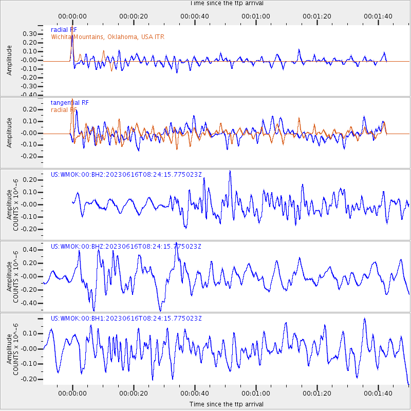
WMOK Wichita Mountains, Oklahoma, USA - Earthquake Result Viewer
*The percent match for this event was below the threshold and hence no stack was calculated.
| Earthquake location: |
Tonga Islands Region |
| Earthquake latitude/longitude: |
-23.6/-175.9 |
| Earthquake time(UTC): |
2023/06/16 (167) 08:11:34 GMT |
| Earthquake Depth: |
22 km |
| Earthquake Magnitude: |
6.0 mww |
| Earthquake Catalog/Contributor: |
NEIC PDE/us |
|
| Network: |
US United States National Seismic Network |
| Station: |
WMOK Wichita Mountains, Oklahoma, USA |
| Lat/Lon: |
34.74 N/98.78 W |
| Elevation: |
486 m |
|
| Distance: |
93.3 deg |
| Az: |
53.521 deg |
| Baz: |
243.617 deg |
| Ray Param: |
$rayparam |
*The percent match for this event was below the threshold and hence was not used in the summary stack. |
|
| Radial Match: |
60.7933 % |
| Radial Bump: |
400 |
| Transverse Match: |
55.95813 % |
| Transverse Bump: |
400 |
| SOD ConfigId: |
30536071 |
| Insert Time: |
2023-06-30 08:39:04.133 +0000 |
| GWidth: |
2.5 |
| Max Bumps: |
400 |
| Tol: |
0.001 |
|
Signal To Noise
| Channel | StoN | STA | LTA |
| US:WMOK:00:BHZ:20230616T08:24:15.775023Z | 2.9223592 | 1.5292063E-7 | 5.2327803E-8 |
| US:WMOK:00:BH1:20230616T08:24:15.775023Z | 1.4976839 | 8.862299E-8 | 5.9173363E-8 |
| US:WMOK:00:BH2:20230616T08:24:15.775023Z | 0.7862511 | 3.1505692E-8 | 4.0070777E-8 |
| Arrivals |
| Ps | |
| PpPs | |
| PsPs/PpSs | |


