You are here: Home > Network List > UU - University of Utah Regional Network Stations List
> Station FORU South Mineral Mountains, UT, USA > Earthquake Result Viewer
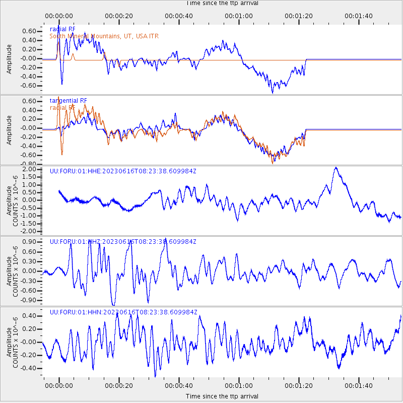
FORU South Mineral Mountains, UT, USA - Earthquake Result Viewer
*The percent match for this event was below the threshold and hence no stack was calculated.
| Earthquake location: |
Tonga Islands Region |
| Earthquake latitude/longitude: |
-23.6/-175.9 |
| Earthquake time(UTC): |
2023/06/16 (167) 08:11:34 GMT |
| Earthquake Depth: |
22 km |
| Earthquake Magnitude: |
6.0 mww |
| Earthquake Catalog/Contributor: |
NEIC PDE/us |
|
| Network: |
UU University of Utah Regional Network |
| Station: |
FORU South Mineral Mountains, UT, USA |
| Lat/Lon: |
38.46 N/112.86 W |
| Elevation: |
1840 m |
|
| Distance: |
85.4 deg |
| Az: |
44.581 deg |
| Baz: |
235.121 deg |
| Ray Param: |
$rayparam |
*The percent match for this event was below the threshold and hence was not used in the summary stack. |
|
| Radial Match: |
67.12496 % |
| Radial Bump: |
400 |
| Transverse Match: |
59.85305 % |
| Transverse Bump: |
400 |
| SOD ConfigId: |
30536071 |
| Insert Time: |
2023-06-30 08:39:23.971 +0000 |
| GWidth: |
2.5 |
| Max Bumps: |
400 |
| Tol: |
0.001 |
|
Signal To Noise
| Channel | StoN | STA | LTA |
| UU:FORU:01:HHZ:20230616T08:23:38.609984Z | 3.8182406 | 3.1543829E-7 | 8.261352E-8 |
| UU:FORU:01:HHN:20230616T08:23:38.609984Z | 1.1996472 | 1.9467669E-7 | 1.6227828E-7 |
| UU:FORU:01:HHE:20230616T08:23:38.609984Z | 1.8119907 | 5.046711E-7 | 2.7851746E-7 |
| Arrivals |
| Ps | |
| PpPs | |
| PsPs/PpSs | |


