You are here: Home > Network List > AV - Alaska Volcano Observatory Stations List
> Station MAPS Pakushin Southeast, Makushin Volcano, Alaska > Earthquake Result Viewer
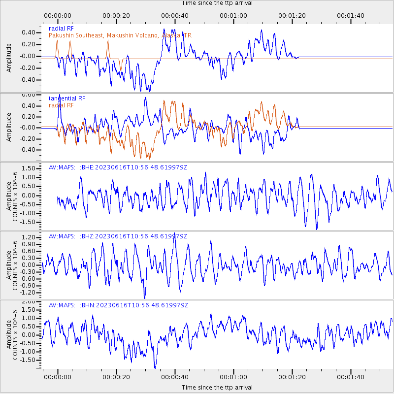
MAPS Pakushin Southeast, Makushin Volcano, Alaska - Earthquake Result Viewer
*The percent match for this event was below the threshold and hence no stack was calculated.
| Earthquake location: |
Tonga Islands Region |
| Earthquake latitude/longitude: |
-23.6/-175.5 |
| Earthquake time(UTC): |
2023/06/16 (167) 10:45:24 GMT |
| Earthquake Depth: |
11 km |
| Earthquake Magnitude: |
5.7 mww |
| Earthquake Catalog/Contributor: |
NEIC PDE/us |
|
| Network: |
AV Alaska Volcano Observatory |
| Station: |
MAPS Pakushin Southeast, Makushin Volcano, Alaska |
| Lat/Lon: |
53.81 N/166.94 W |
| Elevation: |
333 m |
|
| Distance: |
77.4 deg |
| Az: |
5.195 deg |
| Baz: |
188.051 deg |
| Ray Param: |
$rayparam |
*The percent match for this event was below the threshold and hence was not used in the summary stack. |
|
| Radial Match: |
46.645905 % |
| Radial Bump: |
400 |
| Transverse Match: |
46.740406 % |
| Transverse Bump: |
400 |
| SOD ConfigId: |
30536071 |
| Insert Time: |
2023-06-30 10:50:08.120 +0000 |
| GWidth: |
2.5 |
| Max Bumps: |
400 |
| Tol: |
0.001 |
|
Signal To Noise
| Channel | StoN | STA | LTA |
| AV:MAPS: :BHZ:20230616T10:56:48.619979Z | 0.6801113 | 3.090051E-7 | 4.543449E-7 |
| AV:MAPS: :BHN:20230616T10:56:48.619979Z | 0.74605584 | 4.2793778E-7 | 5.736002E-7 |
| AV:MAPS: :BHE:20230616T10:56:48.619979Z | 0.7097537 | 3.2752698E-7 | 4.6146567E-7 |
| Arrivals |
| Ps | |
| PpPs | |
| PsPs/PpSs | |


