You are here: Home > Network List > WW - Idaho Seismic Network () Stations List
> Station BILL Emerald Creek, Idaho > Earthquake Result Viewer
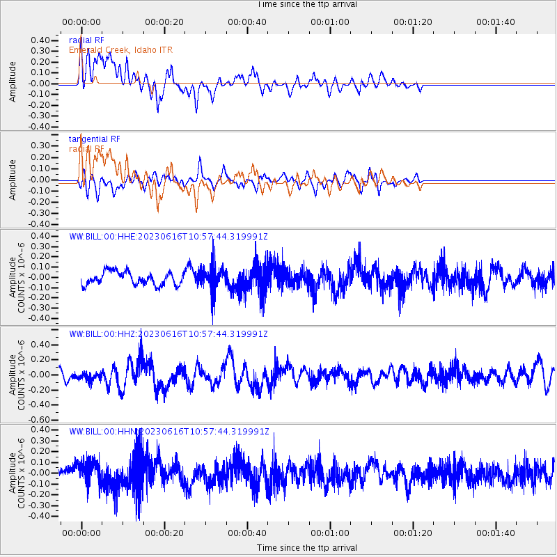
BILL Emerald Creek, Idaho - Earthquake Result Viewer
*The percent match for this event was below the threshold and hence no stack was calculated.
| Earthquake location: |
Tonga Islands Region |
| Earthquake latitude/longitude: |
-23.6/-175.5 |
| Earthquake time(UTC): |
2023/06/16 (167) 10:45:24 GMT |
| Earthquake Depth: |
11 km |
| Earthquake Magnitude: |
5.7 mww |
| Earthquake Catalog/Contributor: |
NEIC PDE/us |
|
| Network: |
WW Idaho Seismic Network () |
| Station: |
BILL Emerald Creek, Idaho |
| Lat/Lon: |
47.03 N/116.34 W |
| Elevation: |
866 m |
|
| Distance: |
88.2 deg |
| Az: |
35.992 deg |
| Baz: |
232.018 deg |
| Ray Param: |
$rayparam |
*The percent match for this event was below the threshold and hence was not used in the summary stack. |
|
| Radial Match: |
61.118446 % |
| Radial Bump: |
400 |
| Transverse Match: |
54.609497 % |
| Transverse Bump: |
400 |
| SOD ConfigId: |
30536071 |
| Insert Time: |
2023-06-30 11:05:56.266 +0000 |
| GWidth: |
2.5 |
| Max Bumps: |
400 |
| Tol: |
0.001 |
|
Signal To Noise
| Channel | StoN | STA | LTA |
| WW:BILL:00:HHZ:20230616T10:57:44.319991Z | 0.7533784 | 5.192717E-8 | 6.892575E-8 |
| WW:BILL:00:HHN:20230616T10:57:44.319991Z | 1.5999659 | 1.0726054E-7 | 6.703927E-8 |
| WW:BILL:00:HHE:20230616T10:57:44.319991Z | 1.9194529 | 1.2142354E-7 | 6.3259456E-8 |
| Arrivals |
| Ps | |
| PpPs | |
| PsPs/PpSs | |


