You are here: Home > Network List > AV - Alaska Volcano Observatory Stations List
> Station MAPS Pakushin Southeast, Makushin Volcano, Alaska > Earthquake Result Viewer
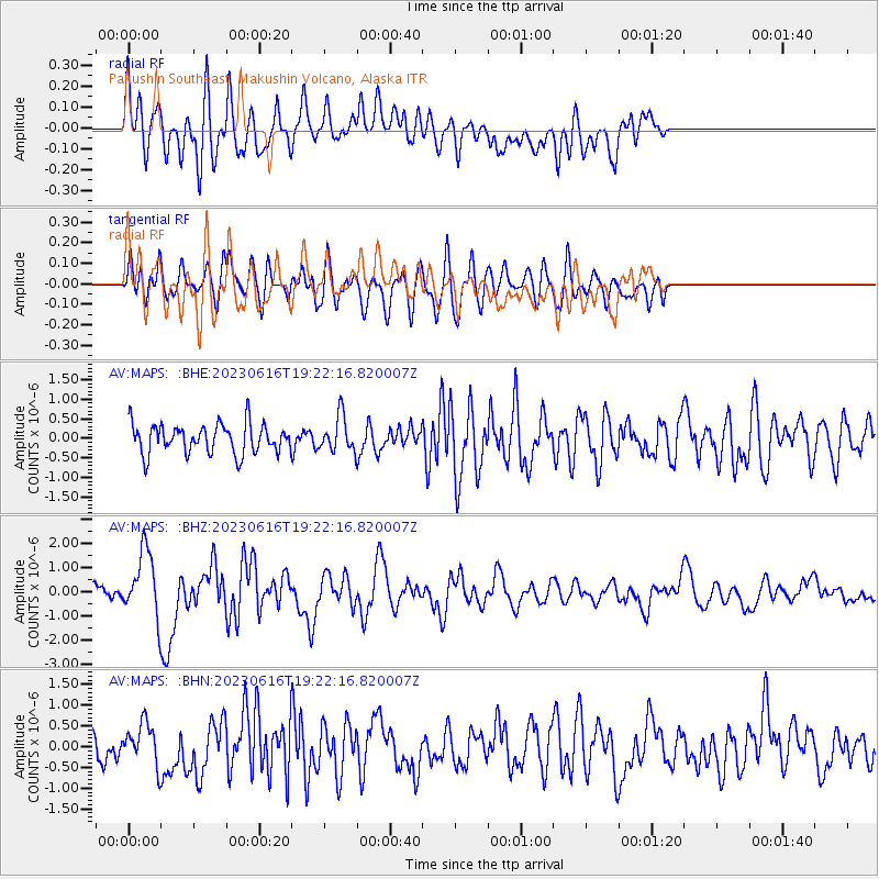
MAPS Pakushin Southeast, Makushin Volcano, Alaska - Earthquake Result Viewer
*The percent match for this event was below the threshold and hence no stack was calculated.
| Earthquake location: |
Tonga Islands Region |
| Earthquake latitude/longitude: |
-23.8/-175.2 |
| Earthquake time(UTC): |
2023/06/16 (167) 19:10:52 GMT |
| Earthquake Depth: |
10 km |
| Earthquake Magnitude: |
6.5 Mi |
| Earthquake Catalog/Contributor: |
NEIC PDE/pt |
|
| Network: |
AV Alaska Volcano Observatory |
| Station: |
MAPS Pakushin Southeast, Makushin Volcano, Alaska |
| Lat/Lon: |
53.81 N/166.94 W |
| Elevation: |
333 m |
|
| Distance: |
77.6 deg |
| Az: |
4.988 deg |
| Baz: |
187.718 deg |
| Ray Param: |
$rayparam |
*The percent match for this event was below the threshold and hence was not used in the summary stack. |
|
| Radial Match: |
66.34739 % |
| Radial Bump: |
400 |
| Transverse Match: |
52.84901 % |
| Transverse Bump: |
400 |
| SOD ConfigId: |
30536071 |
| Insert Time: |
2023-06-30 19:19:29.230 +0000 |
| GWidth: |
2.5 |
| Max Bumps: |
400 |
| Tol: |
0.001 |
|
Signal To Noise
| Channel | StoN | STA | LTA |
| AV:MAPS: :BHZ:20230616T19:22:16.820007Z | 3.9040968 | 1.3214237E-6 | 3.3847104E-7 |
| AV:MAPS: :BHN:20230616T19:22:16.820007Z | 1.208507 | 4.7036824E-7 | 3.8921436E-7 |
| AV:MAPS: :BHE:20230616T19:22:16.820007Z | 1.192344 | 4.460884E-7 | 3.7412727E-7 |
| Arrivals |
| Ps | |
| PpPs | |
| PsPs/PpSs | |


