You are here: Home > Network List > US - United States National Seismic Network Stations List
> Station EGMT Eagleton, Montana, USA > Earthquake Result Viewer
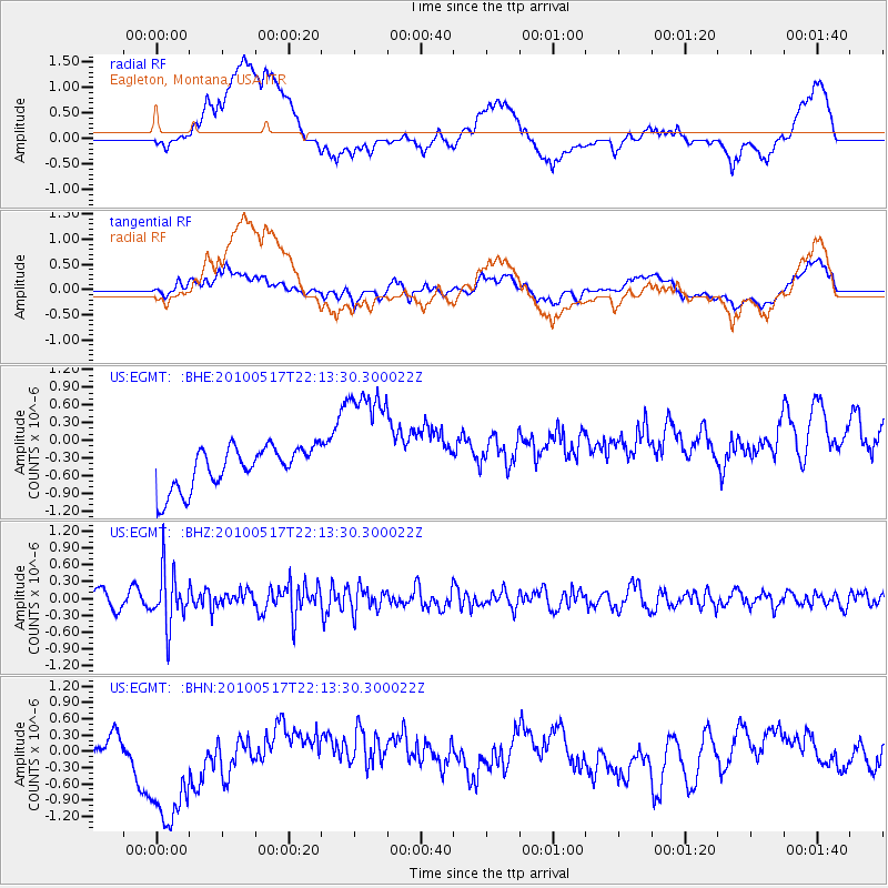
EGMT Eagleton, Montana, USA - Earthquake Result Viewer
*The percent match for this event was below the threshold and hence no stack was calculated.
| Earthquake location: |
Kuril Islands |
| Earthquake latitude/longitude: |
46.3/152.0 |
| Earthquake time(UTC): |
2010/05/17 (137) 22:03:47 GMT |
| Earthquake Depth: |
73 km |
| Earthquake Magnitude: |
5.7 MB, 5.3 MW |
| Earthquake Catalog/Contributor: |
WHDF/NEIC |
|
| Network: |
US United States National Seismic Network |
| Station: |
EGMT Eagleton, Montana, USA |
| Lat/Lon: |
48.02 N/109.75 W |
| Elevation: |
1055 m |
|
| Distance: |
62.1 deg |
| Az: |
48.723 deg |
| Baz: |
309.076 deg |
| Ray Param: |
$rayparam |
*The percent match for this event was below the threshold and hence was not used in the summary stack. |
|
| Radial Match: |
23.616863 % |
| Radial Bump: |
400 |
| Transverse Match: |
31.193464 % |
| Transverse Bump: |
400 |
| SOD ConfigId: |
314592 |
| Insert Time: |
2010-09-04 07:09:02.022 +0000 |
| GWidth: |
2.5 |
| Max Bumps: |
400 |
| Tol: |
0.001 |
|
Signal To Noise
| Channel | StoN | STA | LTA |
| US:EGMT: :BHZ:20100517T22:13:30.300022Z | 3.5799694 | 4.811708E-7 | 1.344064E-7 |
| US:EGMT: :BHN:20100517T22:13:30.300022Z | 2.4787927 | 1.7517033E-6 | 7.06676E-7 |
| US:EGMT: :BHE:20100517T22:13:30.300022Z | 3.0966535 | 1.1005552E-6 | 3.5540148E-7 |
| Arrivals |
| Ps | |
| PpPs | |
| PsPs/PpSs | |


