You are here: Home > Network List > UW - Pacific Northwest Regional Seismic Network Stations List
> Station BLOW Detroit Lake, OR, USA > Earthquake Result Viewer
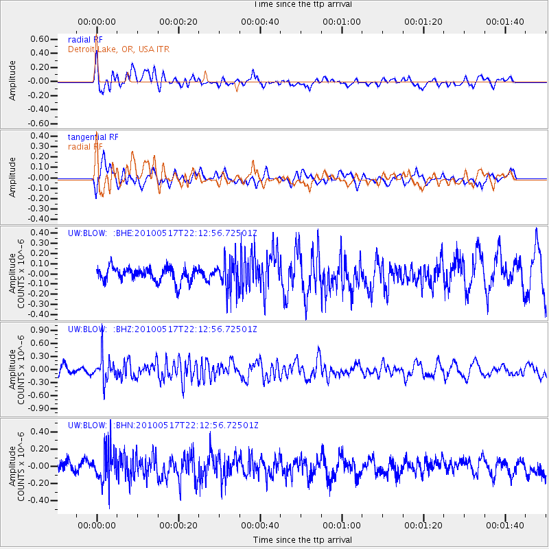
BLOW Detroit Lake, OR, USA - Earthquake Result Viewer
*The percent match for this event was below the threshold and hence no stack was calculated.
| Earthquake location: |
Kuril Islands |
| Earthquake latitude/longitude: |
46.3/152.0 |
| Earthquake time(UTC): |
2010/05/17 (137) 22:03:47 GMT |
| Earthquake Depth: |
73 km |
| Earthquake Magnitude: |
5.7 MB, 5.3 MW |
| Earthquake Catalog/Contributor: |
WHDF/NEIC |
|
| Network: |
UW Pacific Northwest Regional Seismic Network |
| Station: |
BLOW Detroit Lake, OR, USA |
| Lat/Lon: |
44.68 N/122.19 W |
| Elevation: |
652 m |
|
| Distance: |
57.2 deg |
| Az: |
57.784 deg |
| Baz: |
304.673 deg |
| Ray Param: |
$rayparam |
*The percent match for this event was below the threshold and hence was not used in the summary stack. |
|
| Radial Match: |
53.925045 % |
| Radial Bump: |
400 |
| Transverse Match: |
41.157032 % |
| Transverse Bump: |
400 |
| SOD ConfigId: |
314592 |
| Insert Time: |
2010-09-04 07:09:48.072 +0000 |
| GWidth: |
2.5 |
| Max Bumps: |
400 |
| Tol: |
0.001 |
|
Signal To Noise
| Channel | StoN | STA | LTA |
| UW:BLOW: :BHZ:20100517T22:12:56.72501Z | 2.616187 | 2.8849314E-7 | 1.10272374E-7 |
| UW:BLOW: :BHN:20100517T22:12:56.72501Z | 2.9524357 | 1.9141508E-7 | 6.483294E-8 |
| UW:BLOW: :BHE:20100517T22:12:56.72501Z | 2.1609926 | 1.4985785E-7 | 6.934677E-8 |
| Arrivals |
| Ps | |
| PpPs | |
| PsPs/PpSs | |


