You are here: Home > Network List > CN - Canadian National Seismograph Network Stations List
> Station INK INUVIK, NT > Earthquake Result Viewer
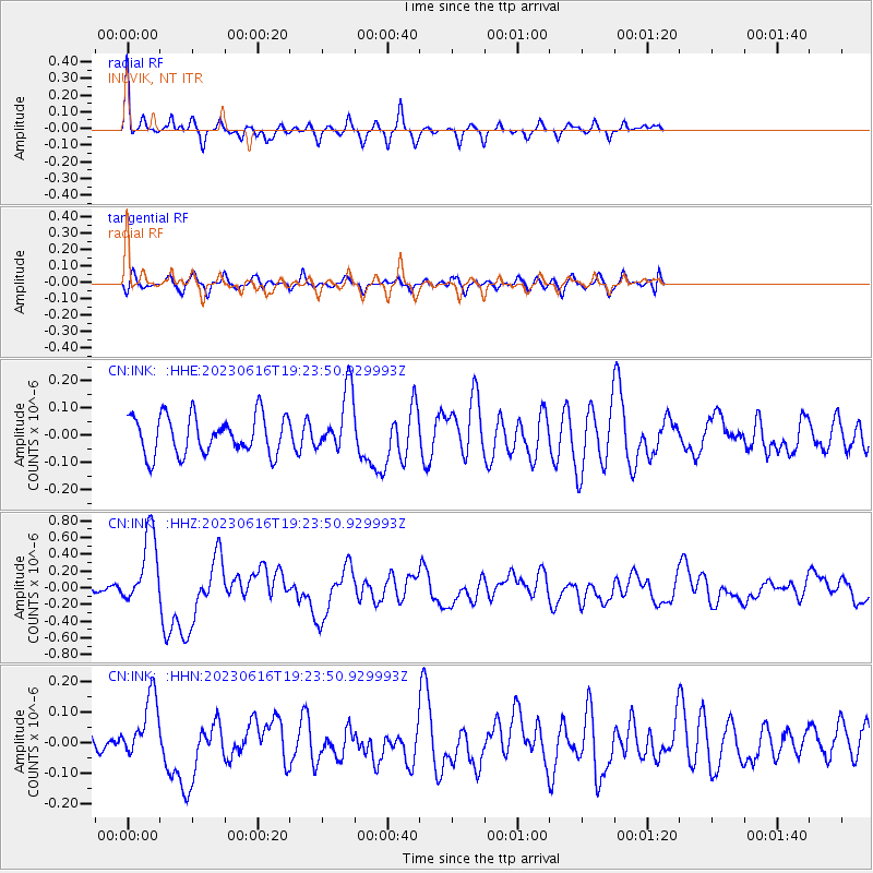
INK INUVIK, NT - Earthquake Result Viewer
*The percent match for this event was below the threshold and hence no stack was calculated.
| Earthquake location: |
Tonga Islands Region |
| Earthquake latitude/longitude: |
-23.8/-175.2 |
| Earthquake time(UTC): |
2023/06/16 (167) 19:10:52 GMT |
| Earthquake Depth: |
10 km |
| Earthquake Magnitude: |
6.5 Mi |
| Earthquake Catalog/Contributor: |
NEIC PDE/pt |
|
| Network: |
CN Canadian National Seismograph Network |
| Station: |
INK INUVIK, NT |
| Lat/Lon: |
68.31 N/133.53 W |
| Elevation: |
44 m |
|
| Distance: |
96.8 deg |
| Az: |
14.406 deg |
| Baz: |
217.81 deg |
| Ray Param: |
$rayparam |
*The percent match for this event was below the threshold and hence was not used in the summary stack. |
|
| Radial Match: |
76.221756 % |
| Radial Bump: |
272 |
| Transverse Match: |
52.936817 % |
| Transverse Bump: |
400 |
| SOD ConfigId: |
30536071 |
| Insert Time: |
2023-06-30 19:25:20.554 +0000 |
| GWidth: |
2.5 |
| Max Bumps: |
400 |
| Tol: |
0.001 |
|
Signal To Noise
| Channel | StoN | STA | LTA |
| CN:INK: :HHZ:20230616T19:23:50.929993Z | 6.004054 | 4.3312525E-7 | 7.2138796E-8 |
| CN:INK: :HHN:20230616T19:23:50.929993Z | 2.5831773 | 1.02589546E-7 | 3.971448E-8 |
| CN:INK: :HHE:20230616T19:23:50.929993Z | 1.5990072 | 1.12216846E-7 | 7.017907E-8 |
| Arrivals |
| Ps | |
| PpPs | |
| PsPs/PpSs | |


