You are here: Home > Network List > IW - Intermountain West Stations List
> Station PLID Pearl Lake, Idaho, USA > Earthquake Result Viewer
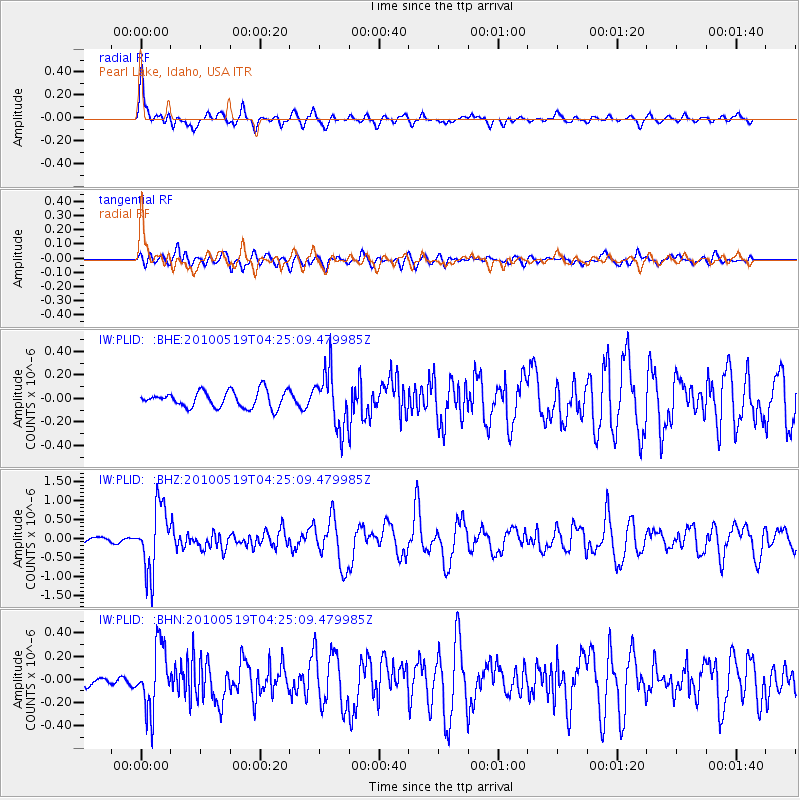
PLID Pearl Lake, Idaho, USA - Earthquake Result Viewer
*The percent match for this event was below the threshold and hence no stack was calculated.
| Earthquake location: |
Northern Peru |
| Earthquake latitude/longitude: |
-5.1/-77.5 |
| Earthquake time(UTC): |
2010/05/19 (139) 04:15:44 GMT |
| Earthquake Depth: |
140 km |
| Earthquake Magnitude: |
6.0 MB, 6.0 MW, 6.0 MW |
| Earthquake Catalog/Contributor: |
WHDF/NEIC |
|
| Network: |
IW Intermountain West |
| Station: |
PLID Pearl Lake, Idaho, USA |
| Lat/Lon: |
45.09 N/116.00 W |
| Elevation: |
2164 m |
|
| Distance: |
60.6 deg |
| Az: |
329.625 deg |
| Baz: |
134.68 deg |
| Ray Param: |
$rayparam |
*The percent match for this event was below the threshold and hence was not used in the summary stack. |
|
| Radial Match: |
78.66117 % |
| Radial Bump: |
400 |
| Transverse Match: |
64.785286 % |
| Transverse Bump: |
400 |
| SOD ConfigId: |
314592 |
| Insert Time: |
2010-09-04 07:18:24.692 +0000 |
| GWidth: |
2.5 |
| Max Bumps: |
400 |
| Tol: |
0.001 |
|
Signal To Noise
| Channel | StoN | STA | LTA |
| IW:PLID: :BHZ:20100519T04:25:09.479985Z | 19.141136 | 8.4916496E-7 | 4.4363354E-8 |
| IW:PLID: :BHN:20100519T04:25:09.479985Z | 7.9624887 | 2.7111858E-7 | 3.4049474E-8 |
| IW:PLID: :BHE:20100519T04:25:09.479985Z | 3.4018848 | 2.3627705E-7 | 6.945474E-8 |
| Arrivals |
| Ps | |
| PpPs | |
| PsPs/PpSs | |


