You are here: Home > Network List > US - United States National Seismic Network Stations List
> Station AMTX Amarillo, Texas, USA > Earthquake Result Viewer
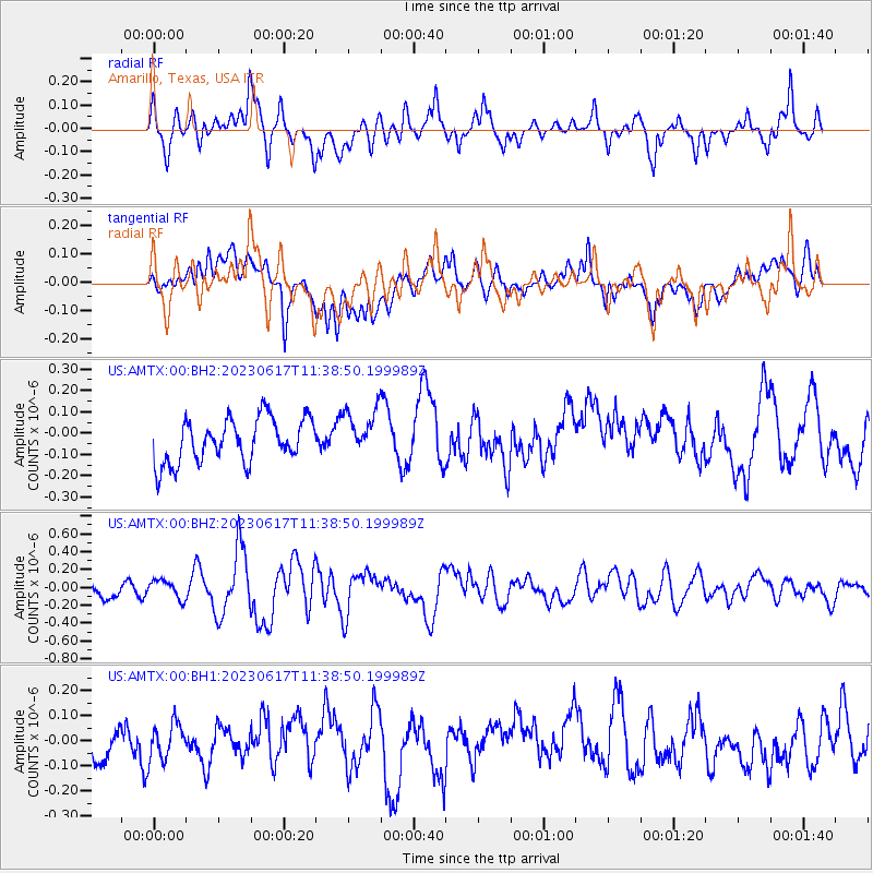
AMTX Amarillo, Texas, USA - Earthquake Result Viewer
*The percent match for this event was below the threshold and hence no stack was calculated.
| Earthquake location: |
Tonga Islands Region |
| Earthquake latitude/longitude: |
-23.4/-175.4 |
| Earthquake time(UTC): |
2023/06/17 (168) 11:26:21 GMT |
| Earthquake Depth: |
35 km |
| Earthquake Magnitude: |
6.0 Mww |
| Earthquake Catalog/Contributor: |
NEIC PDE/us |
|
| Network: |
US United States National Seismic Network |
| Station: |
AMTX Amarillo, Texas, USA |
| Lat/Lon: |
34.53 N/101.41 W |
| Elevation: |
1010 m |
|
| Distance: |
90.8 deg |
| Az: |
52.54 deg |
| Baz: |
242.01 deg |
| Ray Param: |
$rayparam |
*The percent match for this event was below the threshold and hence was not used in the summary stack. |
|
| Radial Match: |
69.474915 % |
| Radial Bump: |
400 |
| Transverse Match: |
54.48006 % |
| Transverse Bump: |
400 |
| SOD ConfigId: |
30536071 |
| Insert Time: |
2023-07-01 11:44:55.267 +0000 |
| GWidth: |
2.5 |
| Max Bumps: |
400 |
| Tol: |
0.001 |
|
Signal To Noise
| Channel | StoN | STA | LTA |
| US:AMTX:00:BHZ:20230617T11:38:50.199989Z | 1.2288848 | 1.0361411E-7 | 8.431556E-8 |
| US:AMTX:00:BH1:20230617T11:38:50.199989Z | 0.9477671 | 7.0743E-8 | 7.4641754E-8 |
| US:AMTX:00:BH2:20230617T11:38:50.199989Z | 1.120194 | 1.1490379E-7 | 1.0257491E-7 |
| Arrivals |
| Ps | |
| PpPs | |
| PsPs/PpSs | |


