You are here: Home > Network List > US - United States National Seismic Network Stations List
> Station EGAK Eagle, Central Alaska, Alaska, USA > Earthquake Result Viewer
EGAK Eagle, Central Alaska, Alaska, USA - Earthquake Result Viewer

| Earthquake location: |
Jan Mayen Island Region |
| Earthquake latitude/longitude: |
71.6/-11.2 |
| Earthquake time(UTC): |
2018/11/09 (313) 01:49:40 GMT |
| Earthquake Depth: |
10 km |
| Earthquake Magnitude: |
6.8 Mww |
| Earthquake Catalog/Contributor: |
NEIC PDE/us |
|
| Network: |
US United States National Seismic Network |
| Station: |
EGAK Eagle, Central Alaska, Alaska, USA |
| Lat/Lon: |
64.78 N/141.16 W |
| Elevation: |
297 m |
|
| Distance: |
39.7 deg |
| Az: |
329.019 deg |
| Baz: |
22.398 deg |
| Ray Param: |
0.074847765 |
| Estimated Moho Depth: |
37.75 km |
| Estimated Crust Vp/Vs: |
1.80 |
| Assumed Crust Vp: |
6.566 km/s |
| Estimated Crust Vs: |
3.648 km/s |
| Estimated Crust Poisson's Ratio: |
0.28 |
|
| Radial Match: |
92.720535 % |
| Radial Bump: |
400 |
| Transverse Match: |
70.3091 % |
| Transverse Bump: |
400 |
| SOD ConfigId: |
3131071 |
| Insert Time: |
2018-11-23 02:02:12.269 +0000 |
| GWidth: |
2.5 |
| Max Bumps: |
400 |
| Tol: |
0.001 |
|
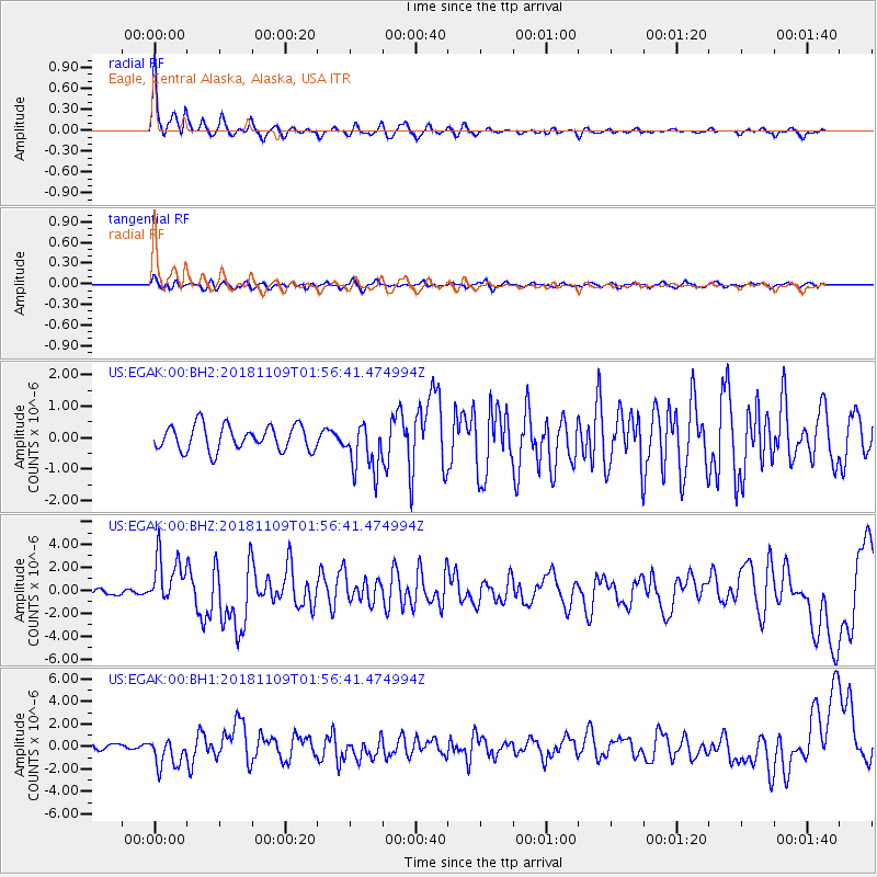
Signal To Noise
| Channel | StoN | STA | LTA |
| US:EGAK:00:BHZ:20181109T01:56:41.474994Z | 7.357575 | 2.1785386E-6 | 2.9609464E-7 |
| US:EGAK:00:BH1:20181109T01:56:41.474994Z | 4.6443076 | 1.2902743E-6 | 2.7781843E-7 |
| US:EGAK:00:BH2:20181109T01:56:41.474994Z | 1.9791871 | 7.832339E-7 | 3.9573513E-7 |
| Arrivals |
| Ps | 4.9 SECOND |
| PpPs | 15 SECOND |
| PsPs/PpSs | 20 SECOND |


