You are here: Home > Network List > GS - US Geological Survey Networks Stations List
> Station OK051 E0350 and S34600 roads, Ralston OK > Earthquake Result Viewer
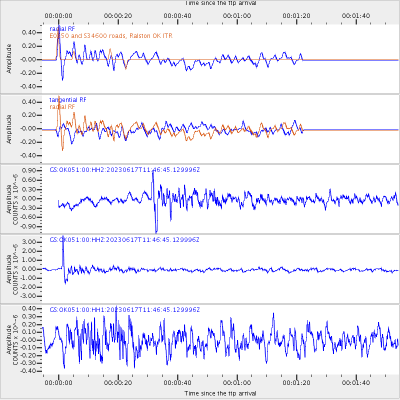
OK051 E0350 and S34600 roads, Ralston OK - Earthquake Result Viewer
*The percent match for this event was below the threshold and hence no stack was calculated.
| Earthquake location: |
Northwest Of Kuril Islands |
| Earthquake latitude/longitude: |
48.0/147.4 |
| Earthquake time(UTC): |
2023/06/17 (168) 11:36:00 GMT |
| Earthquake Depth: |
418 km |
| Earthquake Magnitude: |
5.7 mww |
| Earthquake Catalog/Contributor: |
NEIC PDE/us |
|
| Network: |
GS US Geological Survey Networks |
| Station: |
OK051 E0350 and S34600 roads, Ralston OK |
| Lat/Lon: |
36.50 N/96.84 W |
| Elevation: |
263 m |
|
| Distance: |
78.3 deg |
| Az: |
47.797 deg |
| Baz: |
321.829 deg |
| Ray Param: |
$rayparam |
*The percent match for this event was below the threshold and hence was not used in the summary stack. |
|
| Radial Match: |
70.297104 % |
| Radial Bump: |
400 |
| Transverse Match: |
69.01446 % |
| Transverse Bump: |
400 |
| SOD ConfigId: |
30536071 |
| Insert Time: |
2023-07-01 12:04:37.310 +0000 |
| GWidth: |
2.5 |
| Max Bumps: |
400 |
| Tol: |
0.001 |
|
Signal To Noise
| Channel | StoN | STA | LTA |
| GS:OK051:00:HHZ:20230617T11:46:45.129996Z | 9.8222275 | 9.653701E-7 | 9.8284225E-8 |
| GS:OK051:00:HH1:20230617T11:46:45.129996Z | 1.9058205 | 1.477868E-7 | 7.754498E-8 |
| GS:OK051:00:HH2:20230617T11:46:45.129996Z | 4.10131 | 4.7862034E-7 | 1.166994E-7 |
| Arrivals |
| Ps | |
| PpPs | |
| PsPs/PpSs | |


