You are here: Home > Network List > IW - Intermountain West Stations List
> Station MOOW Moose Ponds, Wyoming, USA > Earthquake Result Viewer
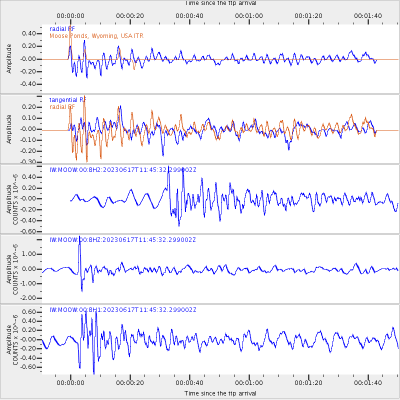
MOOW Moose Ponds, Wyoming, USA - Earthquake Result Viewer
*The percent match for this event was below the threshold and hence no stack was calculated.
| Earthquake location: |
Northwest Of Kuril Islands |
| Earthquake latitude/longitude: |
48.0/147.4 |
| Earthquake time(UTC): |
2023/06/17 (168) 11:36:00 GMT |
| Earthquake Depth: |
418 km |
| Earthquake Magnitude: |
5.7 mww |
| Earthquake Catalog/Contributor: |
NEIC PDE/us |
|
| Network: |
IW Intermountain West |
| Station: |
MOOW Moose Ponds, Wyoming, USA |
| Lat/Lon: |
43.75 N/110.74 W |
| Elevation: |
2128 m |
|
| Distance: |
65.8 deg |
| Az: |
51.024 deg |
| Baz: |
313.856 deg |
| Ray Param: |
$rayparam |
*The percent match for this event was below the threshold and hence was not used in the summary stack. |
|
| Radial Match: |
64.33282 % |
| Radial Bump: |
400 |
| Transverse Match: |
68.1789 % |
| Transverse Bump: |
400 |
| SOD ConfigId: |
30536071 |
| Insert Time: |
2023-07-01 12:06:23.878 +0000 |
| GWidth: |
2.5 |
| Max Bumps: |
400 |
| Tol: |
0.001 |
|
Signal To Noise
| Channel | StoN | STA | LTA |
| IW:MOOW:00:BHZ:20230617T11:45:32.299002Z | 8.37526 | 7.65865E-7 | 9.144373E-8 |
| IW:MOOW:00:BH1:20230617T11:45:32.299002Z | 3.661485 | 2.4495748E-7 | 6.690113E-8 |
| IW:MOOW:00:BH2:20230617T11:45:32.299002Z | 3.490005 | 2.2697503E-7 | 6.5035735E-8 |
| Arrivals |
| Ps | |
| PpPs | |
| PsPs/PpSs | |


