You are here: Home > Network List > US - United States National Seismic Network Stations List
> Station ELK Elko, Nevada, USA > Earthquake Result Viewer
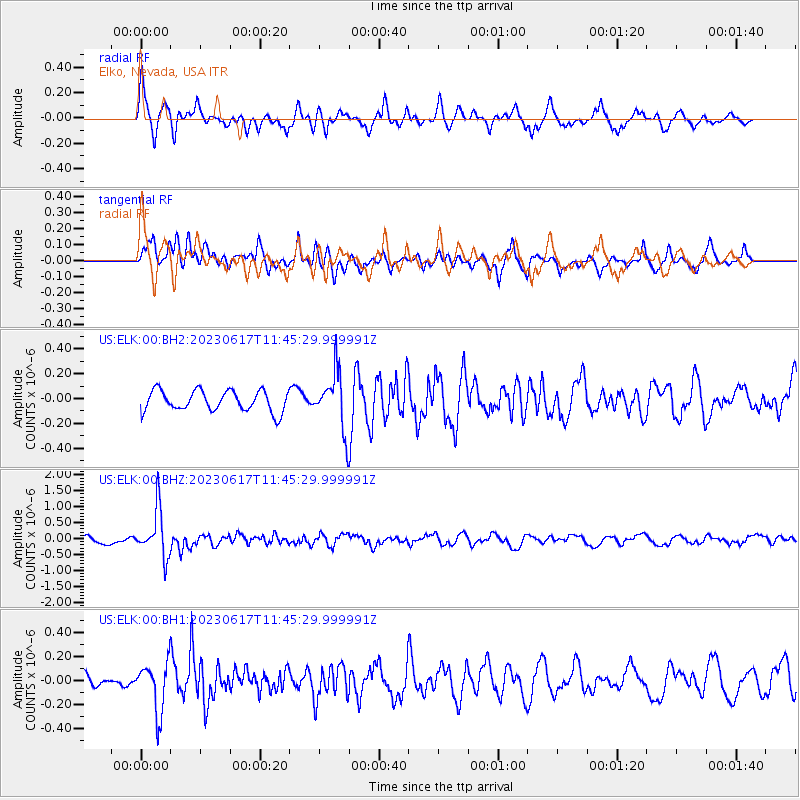
ELK Elko, Nevada, USA - Earthquake Result Viewer
*The percent match for this event was below the threshold and hence no stack was calculated.
| Earthquake location: |
Northwest Of Kuril Islands |
| Earthquake latitude/longitude: |
48.0/147.4 |
| Earthquake time(UTC): |
2023/06/17 (168) 11:36:00 GMT |
| Earthquake Depth: |
418 km |
| Earthquake Magnitude: |
5.7 mww |
| Earthquake Catalog/Contributor: |
NEIC PDE/us |
|
| Network: |
US United States National Seismic Network |
| Station: |
ELK Elko, Nevada, USA |
| Lat/Lon: |
40.74 N/115.24 W |
| Elevation: |
2210 m |
|
| Distance: |
65.4 deg |
| Az: |
55.934 deg |
| Baz: |
312.871 deg |
| Ray Param: |
$rayparam |
*The percent match for this event was below the threshold and hence was not used in the summary stack. |
|
| Radial Match: |
75.517 % |
| Radial Bump: |
381 |
| Transverse Match: |
68.30372 % |
| Transverse Bump: |
400 |
| SOD ConfigId: |
30536071 |
| Insert Time: |
2023-07-01 12:23:14.756 +0000 |
| GWidth: |
2.5 |
| Max Bumps: |
400 |
| Tol: |
0.001 |
|
Signal To Noise
| Channel | StoN | STA | LTA |
| US:ELK:00:BHZ:20230617T11:45:29.999991Z | 7.312403 | 7.4554094E-7 | 1.0195566E-7 |
| US:ELK:00:BH1:20230617T11:45:29.999991Z | 1.5916984 | 2.0580863E-7 | 1.2930127E-7 |
| US:ELK:00:BH2:20230617T11:45:29.999991Z | 2.8146331 | 2.3335303E-7 | 8.290709E-8 |
| Arrivals |
| Ps | |
| PpPs | |
| PsPs/PpSs | |


