You are here: Home > Network List > US - United States National Seismic Network Stations List
> Station WMOK Wichita Mountains, Oklahoma, USA > Earthquake Result Viewer
WMOK Wichita Mountains, Oklahoma, USA - Earthquake Result Viewer
*The percent match for this event was below the threshold and hence no stack was calculated.
| Earthquake location: |
Northwest Of Kuril Islands |
| Earthquake latitude/longitude: |
48.0/147.4 |
| Earthquake time(UTC): |
2023/06/17 (168) 11:36:00 GMT |
| Earthquake Depth: |
418 km |
| Earthquake Magnitude: |
5.7 mww |
| Earthquake Catalog/Contributor: |
NEIC PDE/us |
|
| Network: |
US United States National Seismic Network |
| Station: |
WMOK Wichita Mountains, Oklahoma, USA |
| Lat/Lon: |
34.74 N/98.78 W |
| Elevation: |
486 m |
|
| Distance: |
78.7 deg |
| Az: |
50.183 deg |
| Baz: |
321.176 deg |
| Ray Param: |
$rayparam |
*The percent match for this event was below the threshold and hence was not used in the summary stack. |
|
| Radial Match: |
61.536064 % |
| Radial Bump: |
400 |
| Transverse Match: |
57.686195 % |
| Transverse Bump: |
400 |
| SOD ConfigId: |
30536071 |
| Insert Time: |
2023-07-01 12:23:54.528 +0000 |
| GWidth: |
2.5 |
| Max Bumps: |
400 |
| Tol: |
0.001 |
|
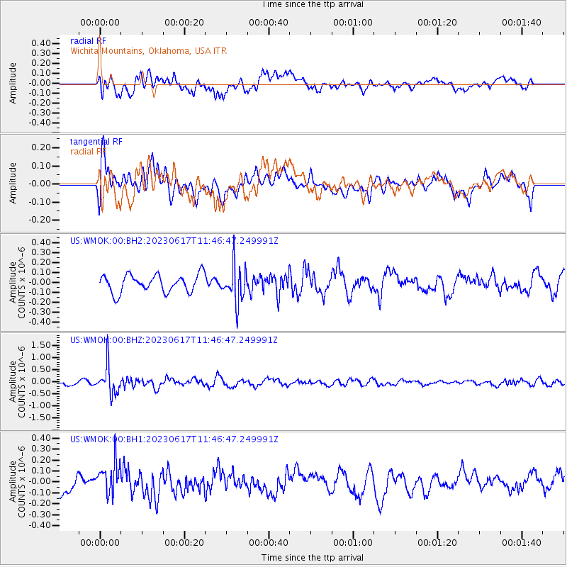
Signal To Noise
| Channel | StoN | STA | LTA |
| US:WMOK:00:BHZ:20230617T11:46:47.249991Z | 9.726613 | 5.855201E-7 | 6.019774E-8 |
| US:WMOK:00:BH1:20230617T11:46:47.249991Z | 2.031597 | 1.4789345E-7 | 7.2796645E-8 |
| US:WMOK:00:BH2:20230617T11:46:47.249991Z | 2.0610127 | 1.8266117E-7 | 8.86269E-8 |
| Arrivals |
| Ps | |
| PpPs | |
| PsPs/PpSs | |


