You are here: Home > Network List > UU - University of Utah Regional Network Stations List
> Station FORU South Mineral Mountains, UT, USA > Earthquake Result Viewer
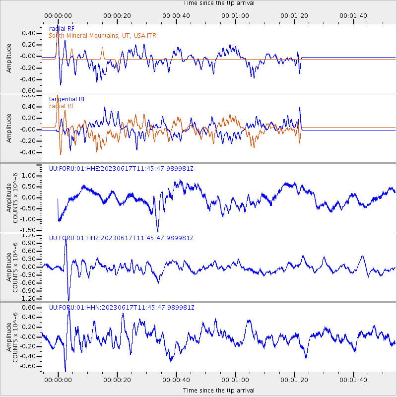
FORU South Mineral Mountains, UT, USA - Earthquake Result Viewer
*The percent match for this event was below the threshold and hence no stack was calculated.
| Earthquake location: |
Northwest Of Kuril Islands |
| Earthquake latitude/longitude: |
48.0/147.4 |
| Earthquake time(UTC): |
2023/06/17 (168) 11:36:00 GMT |
| Earthquake Depth: |
418 km |
| Earthquake Magnitude: |
5.7 mww |
| Earthquake Catalog/Contributor: |
NEIC PDE/us |
|
| Network: |
UU University of Utah Regional Network |
| Station: |
FORU South Mineral Mountains, UT, USA |
| Lat/Lon: |
38.46 N/112.86 W |
| Elevation: |
1840 m |
|
| Distance: |
68.3 deg |
| Az: |
56.348 deg |
| Baz: |
314.543 deg |
| Ray Param: |
$rayparam |
*The percent match for this event was below the threshold and hence was not used in the summary stack. |
|
| Radial Match: |
45.037968 % |
| Radial Bump: |
350 |
| Transverse Match: |
39.38692 % |
| Transverse Bump: |
316 |
| SOD ConfigId: |
30536071 |
| Insert Time: |
2023-07-01 12:24:13.944 +0000 |
| GWidth: |
2.5 |
| Max Bumps: |
400 |
| Tol: |
0.001 |
|
Signal To Noise
| Channel | StoN | STA | LTA |
| UU:FORU:01:HHZ:20230617T11:45:47.989981Z | 2.93951 | 5.414671E-7 | 1.8420317E-7 |
| UU:FORU:01:HHN:20230617T11:45:47.989981Z | 1.9807411 | 2.9371787E-7 | 1.4828686E-7 |
| UU:FORU:01:HHE:20230617T11:45:47.989981Z | 1.7758588 | 6.3800184E-7 | 3.5926385E-7 |
| Arrivals |
| Ps | |
| PpPs | |
| PsPs/PpSs | |


