You are here: Home > Network List > PF - Volcanologic Network of Piton de Fournaise-OVPF Stations List
> Station HIM cratere Himiltrude > Earthquake Result Viewer
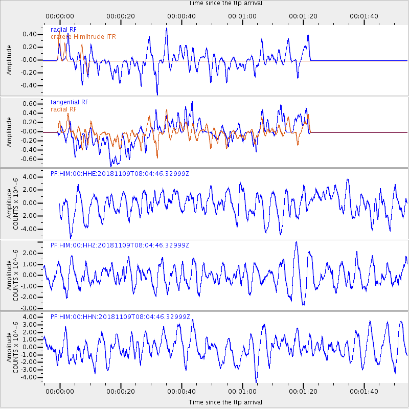
HIM cratere Himiltrude - Earthquake Result Viewer
*The percent match for this event was below the threshold and hence no stack was calculated.
| Earthquake location: |
Southern Mid-Atlantic Ridge |
| Earthquake latitude/longitude: |
-42.7/-16.0 |
| Earthquake time(UTC): |
2018/11/09 (313) 07:54:52 GMT |
| Earthquake Depth: |
10 km |
| Earthquake Magnitude: |
5.8 Mww |
| Earthquake Catalog/Contributor: |
NEIC PDE/us |
|
| Network: |
PF Volcanologic Network of Piton de Fournaise-OVPF |
| Station: |
HIM cratere Himiltrude |
| Lat/Lon: |
21.21 S/55.72 E |
| Elevation: |
1958 m |
|
| Distance: |
62.7 deg |
| Az: |
94.347 deg |
| Baz: |
231.962 deg |
| Ray Param: |
$rayparam |
*The percent match for this event was below the threshold and hence was not used in the summary stack. |
|
| Radial Match: |
58.229244 % |
| Radial Bump: |
400 |
| Transverse Match: |
57.37483 % |
| Transverse Bump: |
400 |
| SOD ConfigId: |
3131071 |
| Insert Time: |
2018-11-23 07:57:32.381 +0000 |
| GWidth: |
2.5 |
| Max Bumps: |
400 |
| Tol: |
0.001 |
|
Signal To Noise
| Channel | StoN | STA | LTA |
| PF:HIM:00:HHZ:20181109T08:04:46.32999Z | 1.3366058 | 1.145457E-6 | 8.569894E-7 |
| PF:HIM:00:HHN:20181109T08:04:46.32999Z | 0.8585075 | 1.921659E-6 | 2.238372E-6 |
| PF:HIM:00:HHE:20181109T08:04:46.32999Z | 0.8733214 | 1.524122E-6 | 1.7452018E-6 |
| Arrivals |
| Ps | |
| PpPs | |
| PsPs/PpSs | |


