You are here: Home > Network List > CI - Caltech Regional Seismic Network Stations List
> Station TUQ Turquiose Mountain, Baker, CA, USA > Earthquake Result Viewer
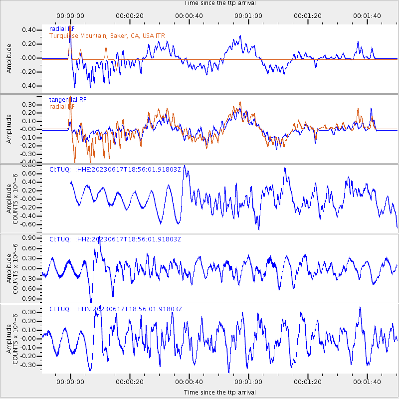
TUQ Turquiose Mountain, Baker, CA, USA - Earthquake Result Viewer
*The percent match for this event was below the threshold and hence no stack was calculated.
| Earthquake location: |
Samoa Islands Region |
| Earthquake latitude/longitude: |
-14.8/-173.0 |
| Earthquake time(UTC): |
2023/06/17 (168) 18:45:00 GMT |
| Earthquake Depth: |
10 km |
| Earthquake Magnitude: |
6.2 Mi |
| Earthquake Catalog/Contributor: |
NEIC PDE/pt |
|
| Network: |
CI Caltech Regional Seismic Network |
| Station: |
TUQ Turquiose Mountain, Baker, CA, USA |
| Lat/Lon: |
35.44 N/115.92 W |
| Elevation: |
1350 m |
|
| Distance: |
73.6 deg |
| Az: |
45.629 deg |
| Baz: |
237.857 deg |
| Ray Param: |
$rayparam |
*The percent match for this event was below the threshold and hence was not used in the summary stack. |
|
| Radial Match: |
58.636047 % |
| Radial Bump: |
400 |
| Transverse Match: |
58.63016 % |
| Transverse Bump: |
400 |
| SOD ConfigId: |
30536071 |
| Insert Time: |
2023-07-01 18:54:53.019 +0000 |
| GWidth: |
2.5 |
| Max Bumps: |
400 |
| Tol: |
0.001 |
|
Signal To Noise
| Channel | StoN | STA | LTA |
| CI:TUQ: :HHZ:20230617T18:56:01.91803Z | 1.3309814 | 1.715703E-7 | 1.2890511E-7 |
| CI:TUQ: :HHN:20230617T18:56:01.91803Z | 0.76212823 | 9.2015064E-8 | 1.2073436E-7 |
| CI:TUQ: :HHE:20230617T18:56:01.91803Z | 2.1187177 | 3.4501485E-7 | 1.6284136E-7 |
| Arrivals |
| Ps | |
| PpPs | |
| PsPs/PpSs | |


