You are here: Home > Network List > TA - USArray Transportable Network (new EarthScope stations) Stations List
> Station M30A Dale-Ortello Valley, Anselmo, NE, USA > Earthquake Result Viewer
M30A Dale-Ortello Valley, Anselmo, NE, USA - Earthquake Result Viewer

| Earthquake location: |
Northern Peru |
| Earthquake latitude/longitude: |
-5.1/-77.5 |
| Earthquake time(UTC): |
2010/05/19 (139) 04:15:44 GMT |
| Earthquake Depth: |
140 km |
| Earthquake Magnitude: |
6.0 MB, 6.0 MW, 6.0 MW |
| Earthquake Catalog/Contributor: |
WHDF/NEIC |
|
| Network: |
TA USArray Transportable Network (new EarthScope stations) |
| Station: |
M30A Dale-Ortello Valley, Anselmo, NE, USA |
| Lat/Lon: |
41.54 N/99.87 W |
| Elevation: |
853 m |
|
| Distance: |
50.7 deg |
| Az: |
338.358 deg |
| Baz: |
150.701 deg |
| Ray Param: |
0.06742968 |
| Estimated Moho Depth: |
13.0 km |
| Estimated Crust Vp/Vs: |
1.60 |
| Assumed Crust Vp: |
6.53 km/s |
| Estimated Crust Vs: |
4.082 km/s |
| Estimated Crust Poisson's Ratio: |
0.18 |
|
| Radial Match: |
93.63171 % |
| Radial Bump: |
368 |
| Transverse Match: |
73.89961 % |
| Transverse Bump: |
400 |
| SOD ConfigId: |
314592 |
| Insert Time: |
2010-09-04 07:36:48.329 +0000 |
| GWidth: |
2.5 |
| Max Bumps: |
400 |
| Tol: |
0.001 |
|
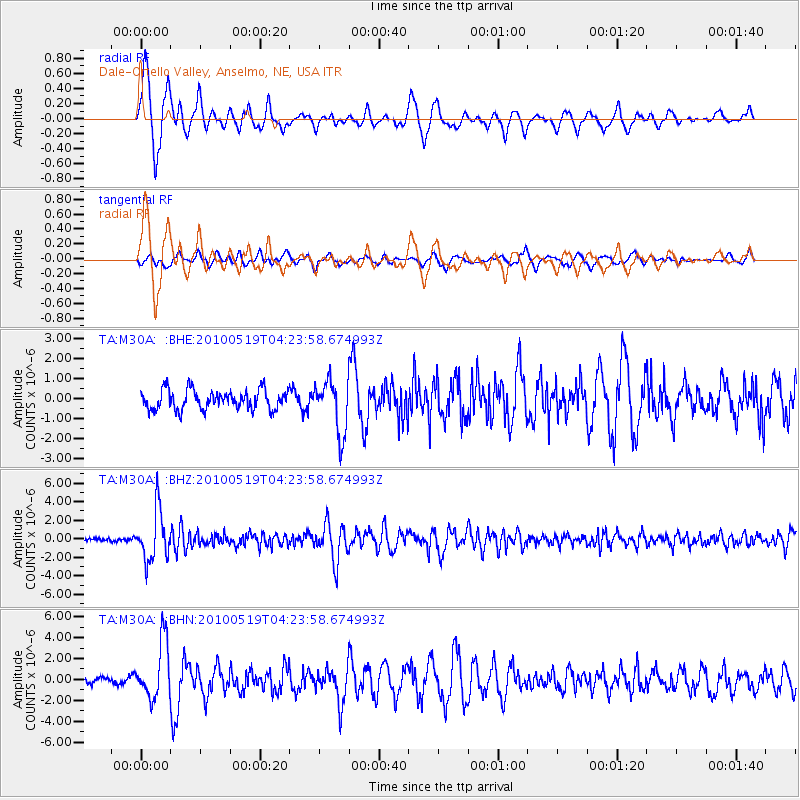
Signal To Noise
| Channel | StoN | STA | LTA |
| TA:M30A: :BHZ:20100519T04:23:58.674993Z | 15.8603945 | 2.6580124E-6 | 1.6758804E-7 |
| TA:M30A: :BHN:20100519T04:23:58.674993Z | 8.669426 | 2.7294577E-6 | 3.148372E-7 |
| TA:M30A: :BHE:20100519T04:23:58.674993Z | 2.7715428 | 1.3233056E-6 | 4.774617E-7 |
| Arrivals |
| Ps | 1.3 SECOND |
| PpPs | 4.8 SECOND |
| PsPs/PpSs | 6.1 SECOND |


