You are here: Home > Network List > TA - USArray Transportable Network (new EarthScope stations) Stations List
> Station Q31A Ellis, KS, USA > Earthquake Result Viewer
Q31A Ellis, KS, USA - Earthquake Result Viewer

| Earthquake location: |
Northern Peru |
| Earthquake latitude/longitude: |
-5.1/-77.5 |
| Earthquake time(UTC): |
2010/05/19 (139) 04:15:44 GMT |
| Earthquake Depth: |
140 km |
| Earthquake Magnitude: |
6.0 MB, 6.0 MW, 6.0 MW |
| Earthquake Catalog/Contributor: |
WHDF/NEIC |
|
| Network: |
TA USArray Transportable Network (new EarthScope stations) |
| Station: |
Q31A Ellis, KS, USA |
| Lat/Lon: |
39.00 N/99.39 W |
| Elevation: |
680 m |
|
| Distance: |
48.3 deg |
| Az: |
337.135 deg |
| Baz: |
150.214 deg |
| Ray Param: |
0.06894838 |
| Estimated Moho Depth: |
43.0 km |
| Estimated Crust Vp/Vs: |
1.79 |
| Assumed Crust Vp: |
6.483 km/s |
| Estimated Crust Vs: |
3.627 km/s |
| Estimated Crust Poisson's Ratio: |
0.27 |
|
| Radial Match: |
95.295944 % |
| Radial Bump: |
340 |
| Transverse Match: |
74.43813 % |
| Transverse Bump: |
400 |
| SOD ConfigId: |
314592 |
| Insert Time: |
2010-09-04 07:36:57.584 +0000 |
| GWidth: |
2.5 |
| Max Bumps: |
400 |
| Tol: |
0.001 |
|
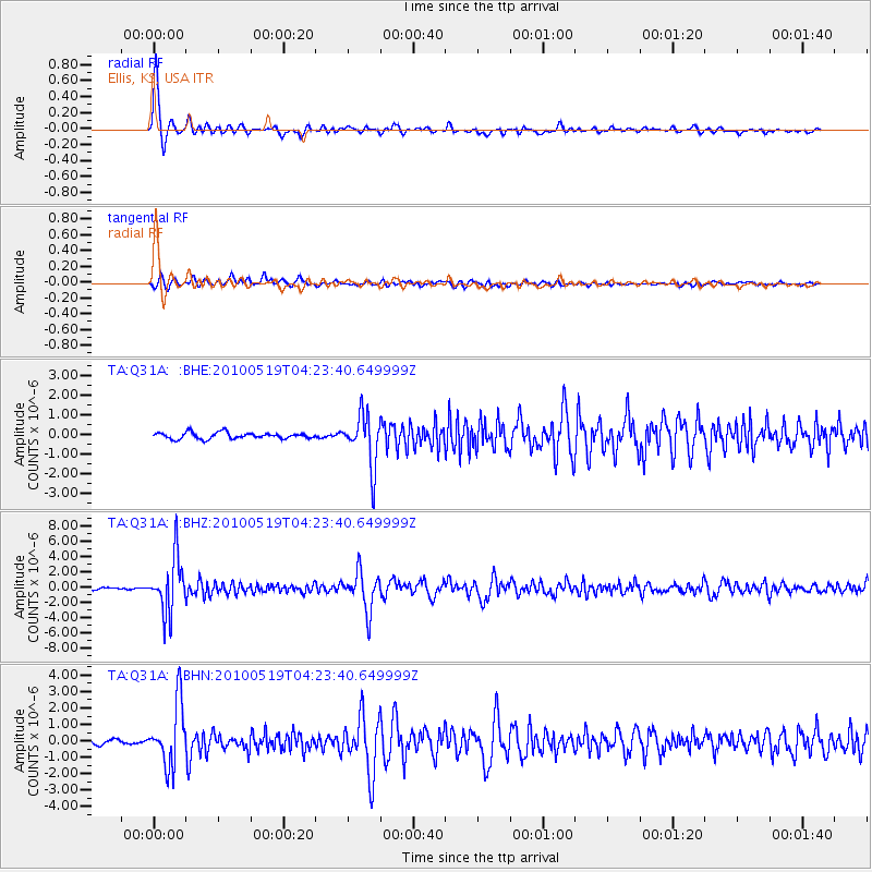
Signal To Noise
| Channel | StoN | STA | LTA |
| TA:Q31A: :BHZ:20100519T04:23:40.649999Z | 38.35691 | 3.5827175E-6 | 9.340474E-8 |
| TA:Q31A: :BHN:20100519T04:23:40.649999Z | 13.1807575 | 1.8896179E-6 | 1.4336186E-7 |
| TA:Q31A: :BHE:20100519T04:23:40.649999Z | 8.201254 | 1.3165396E-6 | 1.6052907E-7 |
| Arrivals |
| Ps | 5.5 SECOND |
| PpPs | 17 SECOND |
| PsPs/PpSs | 23 SECOND |


