You are here: Home > Network List > WW - Idaho Seismic Network () Stations List
> Station BILL Emerald Creek, Idaho > Earthquake Result Viewer
BILL Emerald Creek, Idaho - Earthquake Result Viewer
*The percent match for this event was below the threshold and hence no stack was calculated.
| Earthquake location: |
Samoa Islands Region |
| Earthquake latitude/longitude: |
-14.8/-173.0 |
| Earthquake time(UTC): |
2023/06/17 (168) 18:45:00 GMT |
| Earthquake Depth: |
10 km |
| Earthquake Magnitude: |
6.2 Mi |
| Earthquake Catalog/Contributor: |
NEIC PDE/pt |
|
| Network: |
WW Idaho Seismic Network () |
| Station: |
BILL Emerald Creek, Idaho |
| Lat/Lon: |
47.03 N/116.34 W |
| Elevation: |
866 m |
|
| Distance: |
79.7 deg |
| Az: |
35.521 deg |
| Baz: |
235.244 deg |
| Ray Param: |
$rayparam |
*The percent match for this event was below the threshold and hence was not used in the summary stack. |
|
| Radial Match: |
29.847563 % |
| Radial Bump: |
400 |
| Transverse Match: |
31.133984 % |
| Transverse Bump: |
400 |
| SOD ConfigId: |
30536071 |
| Insert Time: |
2023-07-01 19:09:48.121 +0000 |
| GWidth: |
2.5 |
| Max Bumps: |
400 |
| Tol: |
0.001 |
|
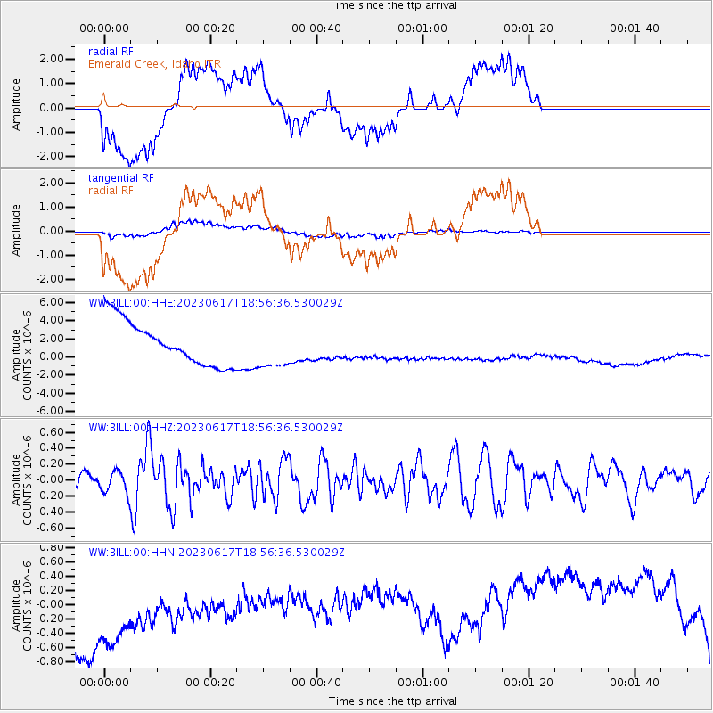
Signal To Noise
| Channel | StoN | STA | LTA |
| WW:BILL:00:HHZ:20230617T18:56:36.530029Z | 1.2105331 | 1.3543756E-7 | 1.1188258E-7 |
| WW:BILL:00:HHN:20230617T18:56:36.530029Z | 1.1503611 | 1.5814065E-6 | 1.3747045E-6 |
| WW:BILL:00:HHE:20230617T18:56:36.530029Z | 0.9998814 | 2.394729E-6 | 2.395013E-6 |
| Arrivals |
| Ps | |
| PpPs | |
| PsPs/PpSs | |


