You are here: Home > Network List > TA - USArray Transportable Network (new EarthScope stations) Stations List
> Station G25A Newell, SD, USA > Earthquake Result Viewer
G25A Newell, SD, USA - Earthquake Result Viewer
*The percent match for this event was below the threshold and hence no stack was calculated.
| Earthquake location: |
Northern Peru |
| Earthquake latitude/longitude: |
-5.1/-77.5 |
| Earthquake time(UTC): |
2010/05/19 (139) 04:15:44 GMT |
| Earthquake Depth: |
140 km |
| Earthquake Magnitude: |
6.0 MB, 6.0 MW, 6.0 MW |
| Earthquake Catalog/Contributor: |
WHDF/NEIC |
|
| Network: |
TA USArray Transportable Network (new EarthScope stations) |
| Station: |
G25A Newell, SD, USA |
| Lat/Lon: |
45.19 N/103.42 W |
| Elevation: |
894 m |
|
| Distance: |
55.1 deg |
| Az: |
337.904 deg |
| Baz: |
148.0 deg |
| Ray Param: |
$rayparam |
*The percent match for this event was below the threshold and hence was not used in the summary stack. |
|
| Radial Match: |
35.40452 % |
| Radial Bump: |
400 |
| Transverse Match: |
23.560802 % |
| Transverse Bump: |
400 |
| SOD ConfigId: |
314592 |
| Insert Time: |
2010-09-04 07:39:03.386 +0000 |
| GWidth: |
2.5 |
| Max Bumps: |
400 |
| Tol: |
0.001 |
|
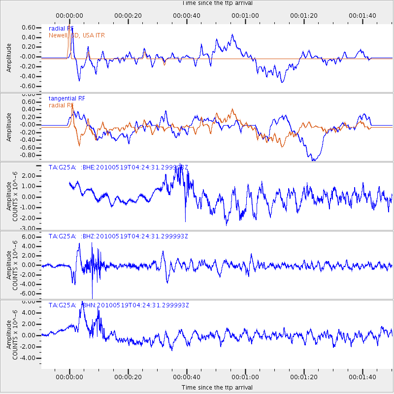
Signal To Noise
| Channel | StoN | STA | LTA |
| TA:G25A: :BHZ:20100519T04:24:31.299993Z | 13.911533 | 2.1364135E-6 | 1.5357139E-7 |
| TA:G25A: :BHN:20100519T04:24:31.299993Z | 2.5861676 | 4.0521973E-6 | 1.5668734E-6 |
| TA:G25A: :BHE:20100519T04:24:31.299993Z | 1.583087 | 9.0500487E-7 | 5.7167097E-7 |
| Arrivals |
| Ps | |
| PpPs | |
| PsPs/PpSs | |


