You are here: Home > Network List > US - United States National Seismic Network Stations List
> Station HAWA Hanford, Washington, USA > Earthquake Result Viewer
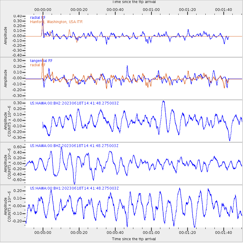
HAWA Hanford, Washington, USA - Earthquake Result Viewer
*The percent match for this event was below the threshold and hence no stack was calculated.
| Earthquake location: |
Tonga Islands Region |
| Earthquake latitude/longitude: |
-24.0/-175.8 |
| Earthquake time(UTC): |
2023/06/18 (169) 14:29:39 GMT |
| Earthquake Depth: |
28 km |
| Earthquake Magnitude: |
5.7 Mww |
| Earthquake Catalog/Contributor: |
NEIC PDE/us |
|
| Network: |
US United States National Seismic Network |
| Station: |
HAWA Hanford, Washington, USA |
| Lat/Lon: |
46.39 N/119.53 W |
| Elevation: |
364 m |
|
| Distance: |
86.6 deg |
| Az: |
35.213 deg |
| Baz: |
229.648 deg |
| Ray Param: |
$rayparam |
*The percent match for this event was below the threshold and hence was not used in the summary stack. |
|
| Radial Match: |
73.53256 % |
| Radial Bump: |
400 |
| Transverse Match: |
57.871857 % |
| Transverse Bump: |
400 |
| SOD ConfigId: |
30536071 |
| Insert Time: |
2023-07-02 14:50:30.768 +0000 |
| GWidth: |
2.5 |
| Max Bumps: |
400 |
| Tol: |
0.001 |
|
Signal To Noise
| Channel | StoN | STA | LTA |
| US:HAWA:00:BHZ:20230618T14:41:48.275003Z | 3.4164157 | 2.2030302E-7 | 6.448367E-8 |
| US:HAWA:00:BH1:20230618T14:41:48.275003Z | 1.59324 | 1.14164756E-7 | 7.165572E-8 |
| US:HAWA:00:BH2:20230618T14:41:48.275003Z | 1.283873 | 1.3361284E-7 | 1.0407014E-7 |
| Arrivals |
| Ps | |
| PpPs | |
| PsPs/PpSs | |


