You are here: Home > Network List > UW - Pacific Northwest Regional Seismic Network Stations List
> Station HOOD Mt Hood Meadows, OR CREST BB SMO > Earthquake Result Viewer
HOOD Mt Hood Meadows, OR CREST BB SMO - Earthquake Result Viewer
*The percent match for this event was below the threshold and hence no stack was calculated.
| Earthquake location: |
Tonga Islands Region |
| Earthquake latitude/longitude: |
-24.0/-175.8 |
| Earthquake time(UTC): |
2023/06/18 (169) 14:29:39 GMT |
| Earthquake Depth: |
28 km |
| Earthquake Magnitude: |
5.7 Mww |
| Earthquake Catalog/Contributor: |
NEIC PDE/us |
|
| Network: |
UW Pacific Northwest Regional Seismic Network |
| Station: |
HOOD Mt Hood Meadows, OR CREST BB SMO |
| Lat/Lon: |
45.32 N/121.65 W |
| Elevation: |
1520 m |
|
| Distance: |
84.7 deg |
| Az: |
35.045 deg |
| Baz: |
228.118 deg |
| Ray Param: |
$rayparam |
*The percent match for this event was below the threshold and hence was not used in the summary stack. |
|
| Radial Match: |
28.270393 % |
| Radial Bump: |
400 |
| Transverse Match: |
31.830833 % |
| Transverse Bump: |
400 |
| SOD ConfigId: |
30536071 |
| Insert Time: |
2023-07-02 14:51:34.878 +0000 |
| GWidth: |
2.5 |
| Max Bumps: |
400 |
| Tol: |
0.001 |
|
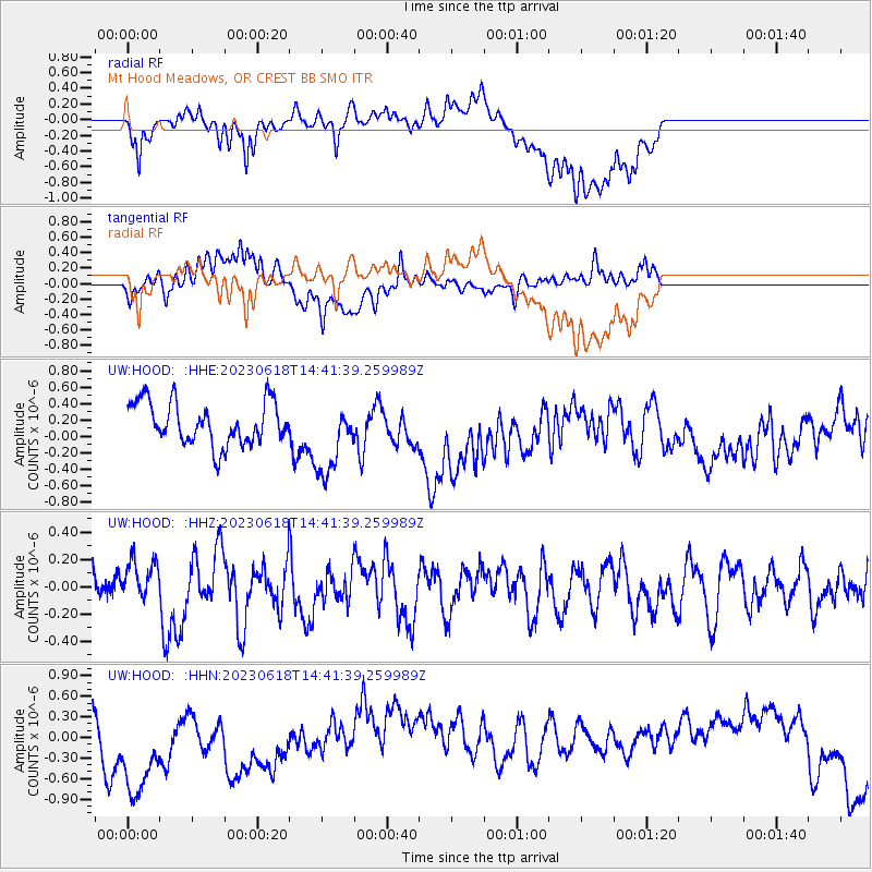
Signal To Noise
| Channel | StoN | STA | LTA |
| UW:HOOD: :HHZ:20230618T14:41:39.259989Z | 1.0843748 | 1.5377582E-7 | 1.4181057E-7 |
| UW:HOOD: :HHN:20230618T14:41:39.259989Z | 3.8316445 | 9.084219E-7 | 2.3708407E-7 |
| UW:HOOD: :HHE:20230618T14:41:39.259989Z | 1.8119503 | 4.686881E-7 | 2.5866498E-7 |
| Arrivals |
| Ps | |
| PpPs | |
| PsPs/PpSs | |


