You are here: Home > Network List > TA - USArray Transportable Network (new EarthScope stations) Stations List
> Station W34A Bridge Creek, Tuttle, OK, USA > Earthquake Result Viewer
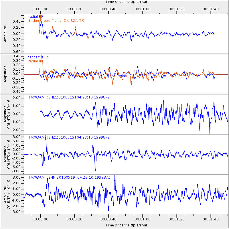
W34A Bridge Creek, Tuttle, OK, USA - Earthquake Result Viewer
*The percent match for this event was below the threshold and hence no stack was calculated.
| Earthquake location: |
Northern Peru |
| Earthquake latitude/longitude: |
-5.1/-77.5 |
| Earthquake time(UTC): |
2010/05/19 (139) 04:15:44 GMT |
| Earthquake Depth: |
140 km |
| Earthquake Magnitude: |
6.0 MB, 6.0 MW, 6.0 MW |
| Earthquake Catalog/Contributor: |
WHDF/NEIC |
|
| Network: |
TA USArray Transportable Network (new EarthScope stations) |
| Station: |
W34A Bridge Creek, Tuttle, OK, USA |
| Lat/Lon: |
35.24 N/97.77 W |
| Elevation: |
428 m |
|
| Distance: |
44.4 deg |
| Az: |
336.12 deg |
| Baz: |
150.488 deg |
| Ray Param: |
$rayparam |
*The percent match for this event was below the threshold and hence was not used in the summary stack. |
|
| Radial Match: |
78.48874 % |
| Radial Bump: |
400 |
| Transverse Match: |
76.88573 % |
| Transverse Bump: |
400 |
| SOD ConfigId: |
314592 |
| Insert Time: |
2010-09-04 07:43:27.750 +0000 |
| GWidth: |
2.5 |
| Max Bumps: |
400 |
| Tol: |
0.001 |
|
Signal To Noise
| Channel | StoN | STA | LTA |
| TA:W34A: :BHZ:20100519T04:23:10.199987Z | 19.991629 | 3.1771986E-6 | 1.5892644E-7 |
| TA:W34A: :BHN:20100519T04:23:10.199987Z | 3.979882 | 1.3350606E-6 | 3.354523E-7 |
| TA:W34A: :BHE:20100519T04:23:10.199987Z | 3.2362742 | 8.5931214E-7 | 2.6552513E-7 |
| Arrivals |
| Ps | |
| PpPs | |
| PsPs/PpSs | |


