You are here: Home > Network List > US - United States National Seismic Network Stations List
> Station DGMT Dagmar, Montana, USA > Earthquake Result Viewer
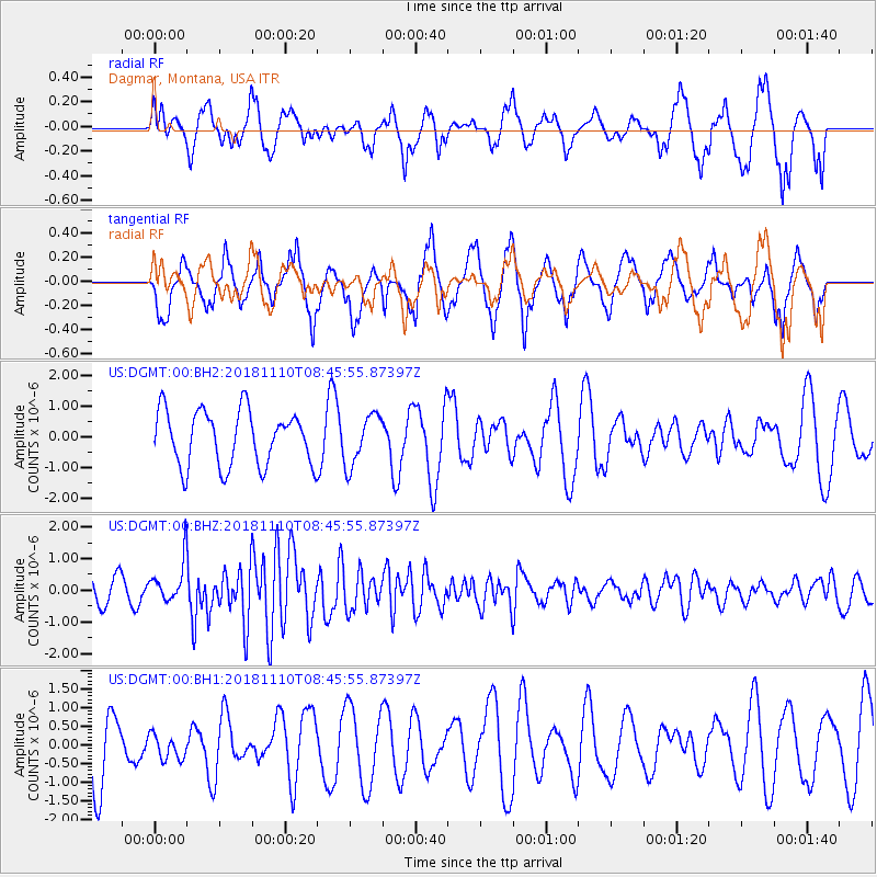
DGMT Dagmar, Montana, USA - Earthquake Result Viewer
*The percent match for this event was below the threshold and hence no stack was calculated.
| Earthquake location: |
Tonga Islands |
| Earthquake latitude/longitude: |
-20.5/-173.8 |
| Earthquake time(UTC): |
2018/11/10 (314) 08:33:16 GMT |
| Earthquake Depth: |
10 km |
| Earthquake Magnitude: |
6.2 Mww |
| Earthquake Catalog/Contributor: |
NEIC PDE/us |
|
| Network: |
US United States National Seismic Network |
| Station: |
DGMT Dagmar, Montana, USA |
| Lat/Lon: |
48.47 N/104.20 W |
| Elevation: |
0.0 m |
|
| Distance: |
92.5 deg |
| Az: |
38.641 deg |
| Baz: |
241.57 deg |
| Ray Param: |
$rayparam |
*The percent match for this event was below the threshold and hence was not used in the summary stack. |
|
| Radial Match: |
53.980957 % |
| Radial Bump: |
324 |
| Transverse Match: |
72.52914 % |
| Transverse Bump: |
359 |
| SOD ConfigId: |
3131071 |
| Insert Time: |
2018-11-24 08:44:56.325 +0000 |
| GWidth: |
2.5 |
| Max Bumps: |
400 |
| Tol: |
0.001 |
|
Signal To Noise
| Channel | StoN | STA | LTA |
| US:DGMT:00:BHZ:20181110T08:45:55.87397Z | 2.0716612 | 6.396787E-7 | 3.087757E-7 |
| US:DGMT:00:BH1:20181110T08:45:55.87397Z | 0.5005407 | 3.3940142E-7 | 6.780696E-7 |
| US:DGMT:00:BH2:20181110T08:45:55.87397Z | 0.9269215 | 8.2324914E-7 | 8.8815415E-7 |
| Arrivals |
| Ps | |
| PpPs | |
| PsPs/PpSs | |


