You are here: Home > Network List > TA - USArray Transportable Network (new EarthScope stations) Stations List
> Station 339A Huntington, TX, USA > Earthquake Result Viewer
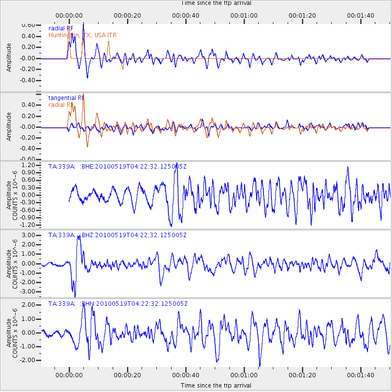
339A Huntington, TX, USA - Earthquake Result Viewer
*The percent match for this event was below the threshold and hence no stack was calculated.
| Earthquake location: |
Northern Peru |
| Earthquake latitude/longitude: |
-5.1/-77.5 |
| Earthquake time(UTC): |
2010/05/19 (139) 04:15:44 GMT |
| Earthquake Depth: |
140 km |
| Earthquake Magnitude: |
6.0 MB, 6.0 MW, 6.0 MW |
| Earthquake Catalog/Contributor: |
WHDF/NEIC |
|
| Network: |
TA USArray Transportable Network (new EarthScope stations) |
| Station: |
339A Huntington, TX, USA |
| Lat/Lon: |
31.33 N/94.56 W |
| Elevation: |
82 m |
|
| Distance: |
39.7 deg |
| Az: |
336.905 deg |
| Baz: |
152.83 deg |
| Ray Param: |
$rayparam |
*The percent match for this event was below the threshold and hence was not used in the summary stack. |
|
| Radial Match: |
89.99742 % |
| Radial Bump: |
400 |
| Transverse Match: |
63.27994 % |
| Transverse Bump: |
400 |
| SOD ConfigId: |
314592 |
| Insert Time: |
2010-09-04 07:47:56.702 +0000 |
| GWidth: |
2.5 |
| Max Bumps: |
400 |
| Tol: |
0.001 |
|
Signal To Noise
| Channel | StoN | STA | LTA |
| TA:339A: :BHZ:20100519T04:22:32.125005Z | 13.374469 | 1.951023E-6 | 1.4587667E-7 |
| TA:339A: :BHN:20100519T04:22:32.125005Z | 6.0129886 | 7.9209843E-7 | 1.3173123E-7 |
| TA:339A: :BHE:20100519T04:22:32.125005Z | 2.0270066 | 5.009611E-7 | 2.4714333E-7 |
| Arrivals |
| Ps | |
| PpPs | |
| PsPs/PpSs | |


