You are here: Home > Network List > AV - Alaska Volcano Observatory Stations List
> Station MAPS Pakushin Southeast, Makushin Volcano, Alaska > Earthquake Result Viewer
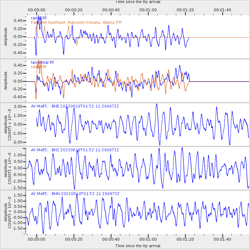
MAPS Pakushin Southeast, Makushin Volcano, Alaska - Earthquake Result Viewer
*The percent match for this event was below the threshold and hence no stack was calculated.
| Earthquake location: |
Near South Coast Of Myanmar |
| Earthquake latitude/longitude: |
15.3/96.3 |
| Earthquake time(UTC): |
2023/06/19 (170) 01:40:23 GMT |
| Earthquake Depth: |
5.3 km |
| Earthquake Magnitude: |
5.4 Mww |
| Earthquake Catalog/Contributor: |
NEIC PDE/us |
|
| Network: |
AV Alaska Volcano Observatory |
| Station: |
MAPS Pakushin Southeast, Makushin Volcano, Alaska |
| Lat/Lon: |
53.81 N/166.94 W |
| Elevation: |
333 m |
|
| Distance: |
81.7 deg |
| Az: |
36.524 deg |
| Baz: |
284.426 deg |
| Ray Param: |
$rayparam |
*The percent match for this event was below the threshold and hence was not used in the summary stack. |
|
| Radial Match: |
56.64613 % |
| Radial Bump: |
400 |
| Transverse Match: |
46.869507 % |
| Transverse Bump: |
400 |
| SOD ConfigId: |
30536071 |
| Insert Time: |
2023-07-03 01:47:01.227 +0000 |
| GWidth: |
2.5 |
| Max Bumps: |
400 |
| Tol: |
0.001 |
|
Signal To Noise
| Channel | StoN | STA | LTA |
| AV:MAPS: :BHZ:20230619T01:52:11.399973Z | 1.017587 | 4.2035197E-7 | 4.1308704E-7 |
| AV:MAPS: :BHN:20230619T01:52:11.399973Z | 1.3920745 | 9.627248E-7 | 6.915757E-7 |
| AV:MAPS: :BHE:20230619T01:52:11.399973Z | 0.43995398 | 3.8672138E-7 | 8.790042E-7 |
| Arrivals |
| Ps | |
| PpPs | |
| PsPs/PpSs | |


