You are here: Home > Network List > TA - USArray Transportable Network (new EarthScope stations) Stations List
> Station X35A Drake, OK, USA > Earthquake Result Viewer
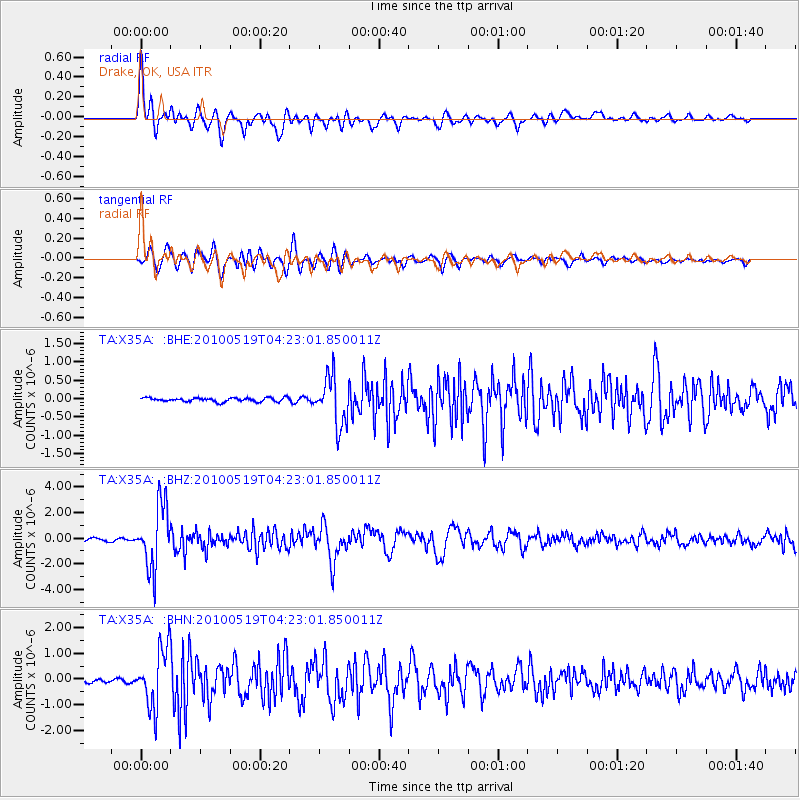
X35A Drake, OK, USA - Earthquake Result Viewer

| Earthquake location: |
Northern Peru |
| Earthquake latitude/longitude: |
-5.1/-77.5 |
| Earthquake time(UTC): |
2010/05/19 (139) 04:15:44 GMT |
| Earthquake Depth: |
140 km |
| Earthquake Magnitude: |
6.0 MB, 6.0 MW, 6.0 MW |
| Earthquake Catalog/Contributor: |
WHDF/NEIC |
|
| Network: |
TA USArray Transportable Network (new EarthScope stations) |
| Station: |
X35A Drake, OK, USA |
| Lat/Lon: |
34.40 N/96.97 W |
| Elevation: |
300 m |
|
| Distance: |
43.3 deg |
| Az: |
336.363 deg |
| Baz: |
151.118 deg |
| Ray Param: |
0.07209519 |
| Estimated Moho Depth: |
21.5 km |
| Estimated Crust Vp/Vs: |
2.09 |
| Assumed Crust Vp: |
6.426 km/s |
| Estimated Crust Vs: |
3.071 km/s |
| Estimated Crust Poisson's Ratio: |
0.35 |
|
| Radial Match: |
90.890976 % |
| Radial Bump: |
400 |
| Transverse Match: |
84.7643 % |
| Transverse Bump: |
400 |
| SOD ConfigId: |
314592 |
| Insert Time: |
2010-09-04 07:49:35.361 +0000 |
| GWidth: |
2.5 |
| Max Bumps: |
400 |
| Tol: |
0.001 |
|
Signal To Noise
| Channel | StoN | STA | LTA |
| TA:X35A: :BHZ:20100519T04:23:01.850011Z | 27.109325 | 2.467611E-6 | 9.102443E-8 |
| TA:X35A: :BHN:20100519T04:23:01.850011Z | 12.653356 | 1.1482581E-6 | 9.074732E-8 |
| TA:X35A: :BHE:20100519T04:23:01.850011Z | 12.947966 | 6.624138E-7 | 5.115968E-8 |
| Arrivals |
| Ps | 3.9 SECOND |
| PpPs | 9.8 SECOND |
| PsPs/PpSs | 14 SECOND |


