You are here: Home > Network List > GS - US Geological Survey Networks Stations List
> Station KAN10 Keim Farm > Earthquake Result Viewer
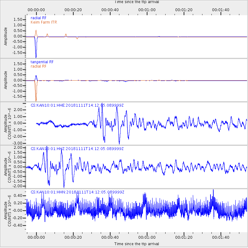
KAN10 Keim Farm - Earthquake Result Viewer
*The percent match for this event was below the threshold and hence no stack was calculated.
| Earthquake location: |
North Atlantic Ocean |
| Earthquake latitude/longitude: |
15.6/-49.9 |
| Earthquake time(UTC): |
2018/11/11 (315) 14:03:59 GMT |
| Earthquake Depth: |
10 km |
| Earthquake Magnitude: |
6.2 mb |
| Earthquake Catalog/Contributor: |
NEIC PDE/us |
|
| Network: |
GS US Geological Survey Networks |
| Station: |
KAN10 Keim Farm |
| Lat/Lon: |
37.12 N/98.10 W |
| Elevation: |
417 m |
|
| Distance: |
47.7 deg |
| Az: |
306.26 deg |
| Baz: |
103.512 deg |
| Ray Param: |
$rayparam |
*The percent match for this event was below the threshold and hence was not used in the summary stack. |
|
| Radial Match: |
99.74375 % |
| Radial Bump: |
30 |
| Transverse Match: |
78.5636 % |
| Transverse Bump: |
232 |
| SOD ConfigId: |
3131071 |
| Insert Time: |
2018-11-25 14:20:13.045 +0000 |
| GWidth: |
2.5 |
| Max Bumps: |
400 |
| Tol: |
0.001 |
|
Signal To Noise
| Channel | StoN | STA | LTA |
| GS:KAN10:01:HHZ:20181111T14:12:05.089999Z | 3.3938348 | 5.7198883E-7 | 1.6853762E-7 |
| GS:KAN10:01:HHN:20181111T14:12:05.089999Z | 1.1640546 | 1.6098423E-7 | 1.3829612E-7 |
| GS:KAN10:01:HHE:20181111T14:12:05.089999Z | 3.7803807 | 8.611771E-7 | 2.2780168E-7 |
| Arrivals |
| Ps | |
| PpPs | |
| PsPs/PpSs | |


