You are here: Home > Network List > GS - US Geological Survey Networks Stations List
> Station KAN13 Rinehart Farm > Earthquake Result Viewer
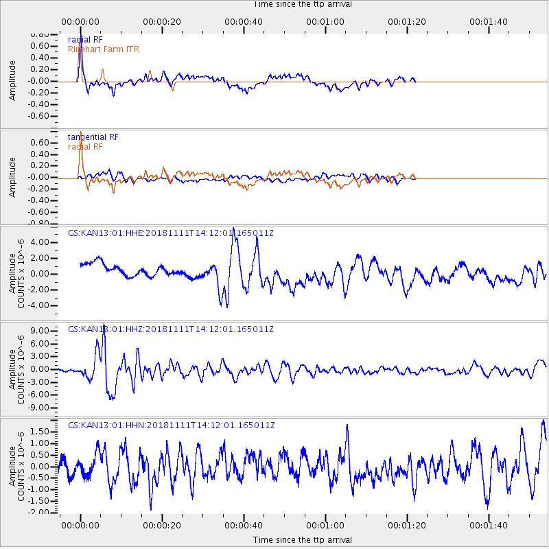
KAN13 Rinehart Farm - Earthquake Result Viewer
*The percent match for this event was below the threshold and hence no stack was calculated.
| Earthquake location: |
North Atlantic Ocean |
| Earthquake latitude/longitude: |
15.6/-49.9 |
| Earthquake time(UTC): |
2018/11/11 (315) 14:03:59 GMT |
| Earthquake Depth: |
10 km |
| Earthquake Magnitude: |
6.2 mb |
| Earthquake Catalog/Contributor: |
NEIC PDE/us |
|
| Network: |
GS US Geological Survey Networks |
| Station: |
KAN13 Rinehart Farm |
| Lat/Lon: |
37.01 N/97.48 W |
| Elevation: |
340 m |
|
| Distance: |
47.2 deg |
| Az: |
306.273 deg |
| Baz: |
103.891 deg |
| Ray Param: |
$rayparam |
*The percent match for this event was below the threshold and hence was not used in the summary stack. |
|
| Radial Match: |
74.171196 % |
| Radial Bump: |
400 |
| Transverse Match: |
45.746326 % |
| Transverse Bump: |
400 |
| SOD ConfigId: |
3131071 |
| Insert Time: |
2018-11-25 14:20:16.245 +0000 |
| GWidth: |
2.5 |
| Max Bumps: |
400 |
| Tol: |
0.001 |
|
Signal To Noise
| Channel | StoN | STA | LTA |
| GS:KAN13:01:HHZ:20181111T14:12:01.165011Z | 9.672379 | 2.8346183E-6 | 2.9306324E-7 |
| GS:KAN13:01:HHN:20181111T14:12:01.165011Z | 1.1316841 | 4.718481E-7 | 4.169433E-7 |
| GS:KAN13:01:HHE:20181111T14:12:01.165011Z | 2.42929 | 1.7141837E-6 | 7.056315E-7 |
| Arrivals |
| Ps | |
| PpPs | |
| PsPs/PpSs | |


