You are here: Home > Network List > UW - Pacific Northwest Regional Seismic Network Stations List
> Station FISH Seaside, OR, USA > Earthquake Result Viewer
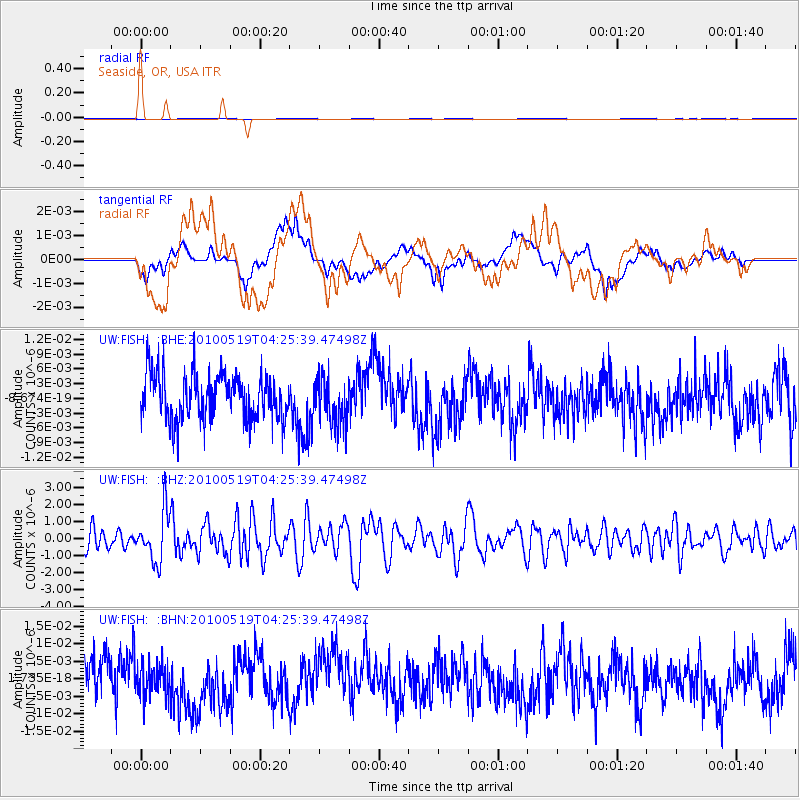
FISH Seaside, OR, USA - Earthquake Result Viewer
*The percent match for this event was below the threshold and hence no stack was calculated.
| Earthquake location: |
Northern Peru |
| Earthquake latitude/longitude: |
-5.1/-77.5 |
| Earthquake time(UTC): |
2010/05/19 (139) 04:15:44 GMT |
| Earthquake Depth: |
140 km |
| Earthquake Magnitude: |
6.0 MB, 6.0 MW, 6.0 MW |
| Earthquake Catalog/Contributor: |
WHDF/NEIC |
|
| Network: |
UW Pacific Northwest Regional Seismic Network |
| Station: |
FISH Seaside, OR, USA |
| Lat/Lon: |
45.93 N/123.56 W |
| Elevation: |
325 m |
|
| Distance: |
65.2 deg |
| Az: |
326.401 deg |
| Baz: |
127.832 deg |
| Ray Param: |
$rayparam |
*The percent match for this event was below the threshold and hence was not used in the summary stack. |
|
| Radial Match: |
49.13285 % |
| Radial Bump: |
400 |
| Transverse Match: |
50.66333 % |
| Transverse Bump: |
400 |
| SOD ConfigId: |
314592 |
| Insert Time: |
2010-09-04 07:56:17.997 +0000 |
| GWidth: |
2.5 |
| Max Bumps: |
400 |
| Tol: |
0.001 |
|
Signal To Noise
| Channel | StoN | STA | LTA |
| UW:FISH: :BHZ:20100519T04:25:39.47498Z | 2.8846684 | 1.4368346E-6 | 4.980935E-7 |
| UW:FISH: :BHN:20100519T04:25:39.47498Z | 0.8383539 | 4.4262154E-9 | 5.2796505E-9 |
| UW:FISH: :BHE:20100519T04:25:39.47498Z | 0.9885398 | 4.571089E-9 | 4.6240816E-9 |
| Arrivals |
| Ps | |
| PpPs | |
| PsPs/PpSs | |


