You are here: Home > Network List > AZ - ANZA Regional Network Stations List
> Station PFO AZ.PFO > Earthquake Result Viewer
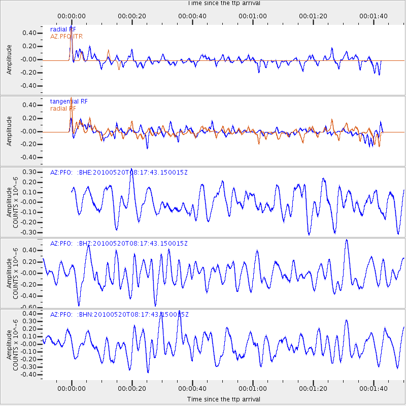
PFO AZ.PFO - Earthquake Result Viewer
*The percent match for this event was below the threshold and hence no stack was calculated.
| Earthquake location: |
Southeast Of Easter Island |
| Earthquake latitude/longitude: |
-39.1/-92.2 |
| Earthquake time(UTC): |
2010/05/20 (140) 08:06:28 GMT |
| Earthquake Depth: |
10 km |
| Earthquake Magnitude: |
5.5 MB, 5.6 MS, 5.9 MW, 5.9 MW |
| Earthquake Catalog/Contributor: |
WHDF/NEIC |
|
| Network: |
AZ ANZA Regional Network |
| Station: |
PFO AZ.PFO |
| Lat/Lon: |
33.61 N/116.46 W |
| Elevation: |
1259 m |
|
| Distance: |
75.7 deg |
| Az: |
339.247 deg |
| Baz: |
160.697 deg |
| Ray Param: |
$rayparam |
*The percent match for this event was below the threshold and hence was not used in the summary stack. |
|
| Radial Match: |
60.60478 % |
| Radial Bump: |
344 |
| Transverse Match: |
57.833237 % |
| Transverse Bump: |
400 |
| SOD ConfigId: |
314592 |
| Insert Time: |
2010-09-04 08:02:15.589 +0000 |
| GWidth: |
2.5 |
| Max Bumps: |
400 |
| Tol: |
0.001 |
|
Signal To Noise
| Channel | StoN | STA | LTA |
| AZ:PFO: :BHZ:20100520T08:17:43.150015Z | 2.208151 | 2.6479393E-7 | 1.1991658E-7 |
| AZ:PFO: :BHN:20100520T08:17:43.150015Z | 0.9622485 | 1.1741613E-7 | 1.2202267E-7 |
| AZ:PFO: :BHE:20100520T08:17:43.150015Z | 0.5921596 | 7.3177134E-8 | 1.2357671E-7 |
| Arrivals |
| Ps | |
| PpPs | |
| PsPs/PpSs | |


