You are here: Home > Network List > US - United States National Seismic Network Stations List
> Station GLMI Grayling, Michigan, USA > Earthquake Result Viewer
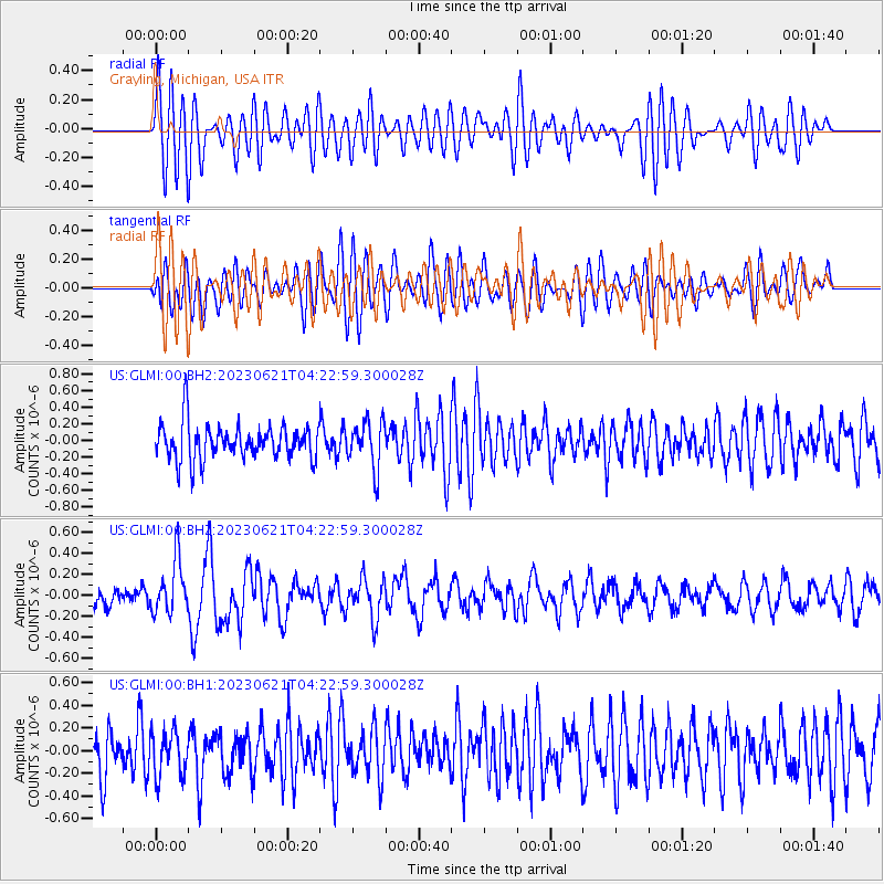
GLMI Grayling, Michigan, USA - Earthquake Result Viewer
*The percent match for this event was below the threshold and hence no stack was calculated.
| Earthquake location: |
Southern Mid-Atlantic Ridge |
| Earthquake latitude/longitude: |
-12.9/-14.7 |
| Earthquake time(UTC): |
2023/06/21 (172) 04:10:53 GMT |
| Earthquake Depth: |
10 km |
| Earthquake Magnitude: |
5.5 mww |
| Earthquake Catalog/Contributor: |
NEIC PDE/us |
|
| Network: |
US United States National Seismic Network |
| Station: |
GLMI Grayling, Michigan, USA |
| Lat/Lon: |
44.82 N/84.62 W |
| Elevation: |
387 m |
|
| Distance: |
85.3 deg |
| Az: |
317.869 deg |
| Baz: |
113.178 deg |
| Ray Param: |
$rayparam |
*The percent match for this event was below the threshold and hence was not used in the summary stack. |
|
| Radial Match: |
63.93629 % |
| Radial Bump: |
400 |
| Transverse Match: |
57.579277 % |
| Transverse Bump: |
400 |
| SOD ConfigId: |
30536071 |
| Insert Time: |
2023-07-05 04:30:20.652 +0000 |
| GWidth: |
2.5 |
| Max Bumps: |
400 |
| Tol: |
0.001 |
|
Signal To Noise
| Channel | StoN | STA | LTA |
| US:GLMI:00:BHZ:20230621T04:22:59.300028Z | 1.9499055 | 2.5103006E-7 | 1.287396E-7 |
| US:GLMI:00:BH1:20230621T04:22:59.300028Z | 1.022021 | 1.9439872E-7 | 1.9021009E-7 |
| US:GLMI:00:BH2:20230621T04:22:59.300028Z | 1.2871318 | 2.746477E-7 | 2.1337964E-7 |
| Arrivals |
| Ps | |
| PpPs | |
| PsPs/PpSs | |


