You are here: Home > Network List > TA - USArray Transportable Network (new EarthScope stations) Stations List
> Station 232A Coleman, TX, USA > Earthquake Result Viewer
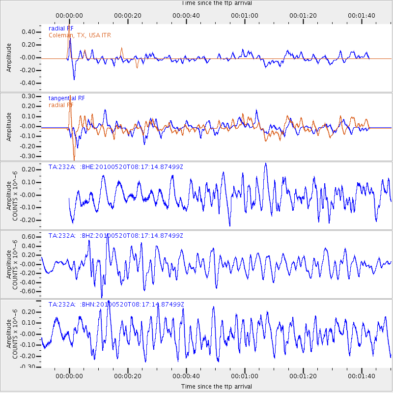
232A Coleman, TX, USA - Earthquake Result Viewer
*The percent match for this event was below the threshold and hence no stack was calculated.
| Earthquake location: |
Southeast Of Easter Island |
| Earthquake latitude/longitude: |
-39.1/-92.2 |
| Earthquake time(UTC): |
2010/05/20 (140) 08:06:28 GMT |
| Earthquake Depth: |
10 km |
| Earthquake Magnitude: |
5.5 MB, 5.6 MS, 5.9 MW, 5.9 MW |
| Earthquake Catalog/Contributor: |
WHDF/NEIC |
|
| Network: |
TA USArray Transportable Network (new EarthScope stations) |
| Station: |
232A Coleman, TX, USA |
| Lat/Lon: |
31.89 N/99.65 W |
| Elevation: |
621 m |
|
| Distance: |
70.9 deg |
| Az: |
353.264 deg |
| Baz: |
173.838 deg |
| Ray Param: |
$rayparam |
*The percent match for this event was below the threshold and hence was not used in the summary stack. |
|
| Radial Match: |
64.27141 % |
| Radial Bump: |
400 |
| Transverse Match: |
59.895767 % |
| Transverse Bump: |
400 |
| SOD ConfigId: |
314592 |
| Insert Time: |
2010-09-04 08:06:27.354 +0000 |
| GWidth: |
2.5 |
| Max Bumps: |
400 |
| Tol: |
0.001 |
|
Signal To Noise
| Channel | StoN | STA | LTA |
| TA:232A: :BHZ:20100520T08:17:14.87499Z | 0.9497187 | 1.1675028E-7 | 1.2293144E-7 |
| TA:232A: :BHN:20100520T08:17:14.87499Z | 1.0102102 | 1.0464323E-7 | 1.03585606E-7 |
| TA:232A: :BHE:20100520T08:17:14.87499Z | 0.72203946 | 5.658426E-8 | 7.8367265E-8 |
| Arrivals |
| Ps | |
| PpPs | |
| PsPs/PpSs | |


