You are here: Home > Network List > TA - USArray Transportable Network (new EarthScope stations) Stations List
> Station POKR Poker Plat Research Range, AK, USA > Earthquake Result Viewer
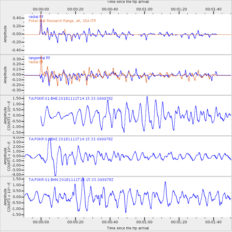
POKR Poker Plat Research Range, AK, USA - Earthquake Result Viewer
*The percent match for this event was below the threshold and hence no stack was calculated.
| Earthquake location: |
North Atlantic Ocean |
| Earthquake latitude/longitude: |
15.6/-49.9 |
| Earthquake time(UTC): |
2018/11/11 (315) 14:03:59 GMT |
| Earthquake Depth: |
10 km |
| Earthquake Magnitude: |
6.2 mb |
| Earthquake Catalog/Contributor: |
NEIC PDE/us |
|
| Network: |
TA USArray Transportable Network (new EarthScope stations) |
| Station: |
POKR Poker Plat Research Range, AK, USA |
| Lat/Lon: |
65.12 N/147.43 W |
| Elevation: |
501 m |
|
| Distance: |
79.2 deg |
| Az: |
334.722 deg |
| Baz: |
76.587 deg |
| Ray Param: |
$rayparam |
*The percent match for this event was below the threshold and hence was not used in the summary stack. |
|
| Radial Match: |
72.93122 % |
| Radial Bump: |
400 |
| Transverse Match: |
67.590126 % |
| Transverse Bump: |
400 |
| SOD ConfigId: |
3131071 |
| Insert Time: |
2018-11-25 14:22:32.778 +0000 |
| GWidth: |
2.5 |
| Max Bumps: |
400 |
| Tol: |
0.001 |
|
Signal To Noise
| Channel | StoN | STA | LTA |
| TA:POKR:01:BHZ:20181111T14:15:33.099978Z | 3.588952 | 1.396973E-6 | 3.8924256E-7 |
| TA:POKR:01:BHN:20181111T14:15:33.099978Z | 0.98517287 | 2.7389953E-7 | 2.7802182E-7 |
| TA:POKR:01:BHE:20181111T14:15:33.099978Z | 1.1748933 | 4.5477628E-7 | 3.870788E-7 |
| Arrivals |
| Ps | |
| PpPs | |
| PsPs/PpSs | |


