You are here: Home > Network List > IW - Intermountain West Stations List
> Station MOOW Moose Ponds, Wyoming, USA > Earthquake Result Viewer
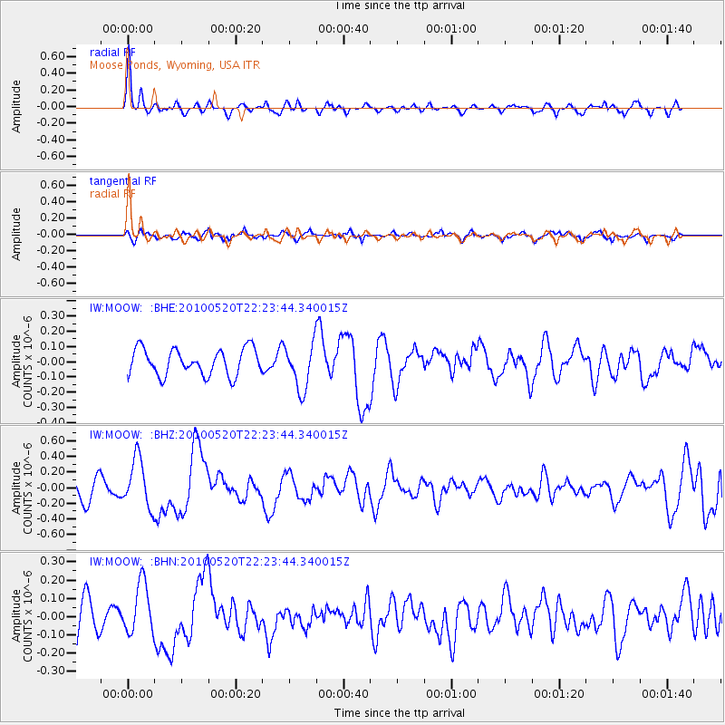
MOOW Moose Ponds, Wyoming, USA - Earthquake Result Viewer
*The percent match for this event was below the threshold and hence no stack was calculated.
| Earthquake location: |
Costa Rica |
| Earthquake latitude/longitude: |
9.2/-84.3 |
| Earthquake time(UTC): |
2010/05/20 (140) 22:16:30 GMT |
| Earthquake Depth: |
21 km |
| Earthquake Magnitude: |
5.6 MB, 5.6 MS, 5.9 MW, 5.9 MW |
| Earthquake Catalog/Contributor: |
WHDF/NEIC |
|
| Network: |
IW Intermountain West |
| Station: |
MOOW Moose Ponds, Wyoming, USA |
| Lat/Lon: |
43.75 N/110.74 W |
| Elevation: |
2128 m |
|
| Distance: |
41.4 deg |
| Az: |
330.767 deg |
| Baz: |
138.299 deg |
| Ray Param: |
$rayparam |
*The percent match for this event was below the threshold and hence was not used in the summary stack. |
|
| Radial Match: |
78.59875 % |
| Radial Bump: |
400 |
| Transverse Match: |
61.763126 % |
| Transverse Bump: |
400 |
| SOD ConfigId: |
314592 |
| Insert Time: |
2010-09-04 08:18:08.423 +0000 |
| GWidth: |
2.5 |
| Max Bumps: |
400 |
| Tol: |
0.001 |
|
Signal To Noise
| Channel | StoN | STA | LTA |
| IW:MOOW: :BHZ:20100520T22:23:44.340015Z | 2.389063 | 3.1405406E-7 | 1.3145491E-7 |
| IW:MOOW: :BHN:20100520T22:23:44.340015Z | 1.3156167 | 1.4087927E-7 | 1.070823E-7 |
| IW:MOOW: :BHE:20100520T22:23:44.340015Z | 1.7563457 | 1.517096E-7 | 8.637798E-8 |
| Arrivals |
| Ps | |
| PpPs | |
| PsPs/PpSs | |


