
SA45 XA.SA45 - Earthquake Result Viewer
| ||||||||||||||||||
| ||||||||||||||||||
| ||||||||||||||||||
|
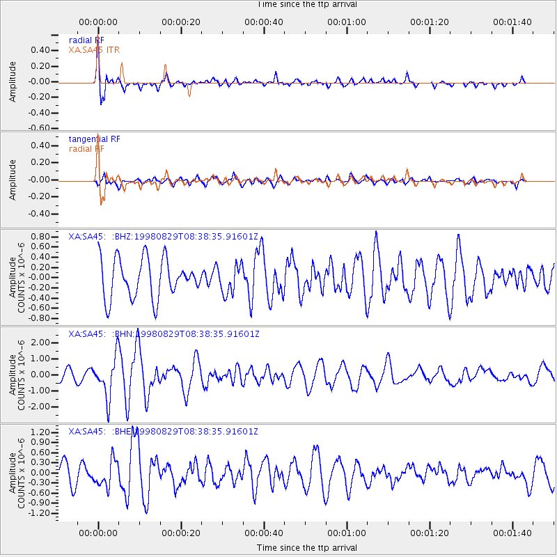
Signal To Noise
| Channel | StoN | STA | LTA |
| XA:SA45: :BHN:19980829T08:38:35.91601Z | 3.6480927 | 1.3052711E-6 | 3.577955E-7 |
| XA:SA45: :BHE:19980829T08:38:35.91601Z | 1.4781623 | 3.983274E-7 | 2.6947475E-7 |
| XA:SA45: :BHZ:19980829T08:38:35.91601Z | 0.727366 | 2.7651814E-7 | 3.801637E-7 |
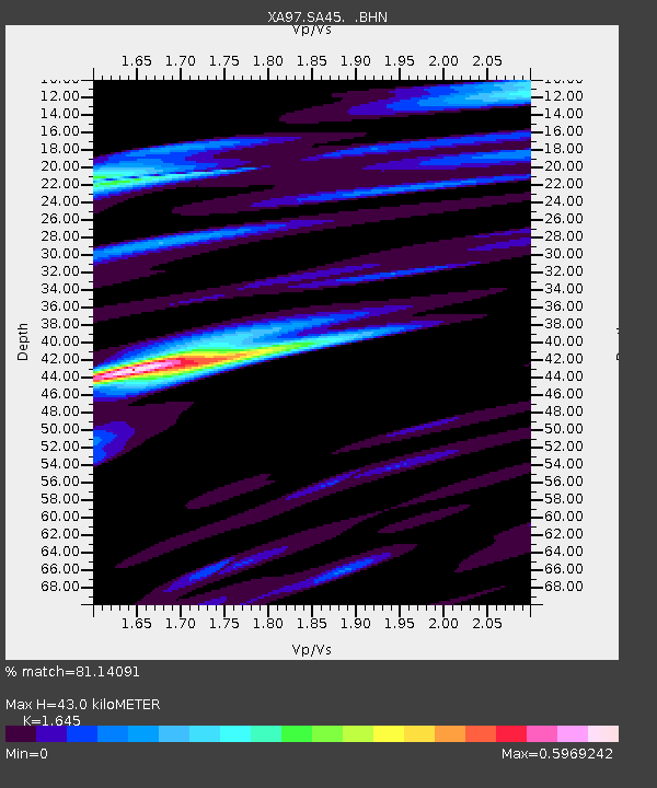
| Arrivals | |
| Ps | 4.6 SECOND |
| PpPs | 17 SECOND |
| PsPs/PpSs | 21 SECOND |

