
SA45 XA.SA45 - Earthquake Result Viewer
| ||||||||||||||||||
| ||||||||||||||||||
| ||||||||||||||||||
|
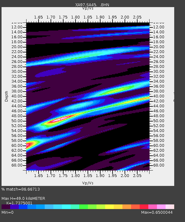
Signal To Noise
| Channel | StoN | STA | LTA |
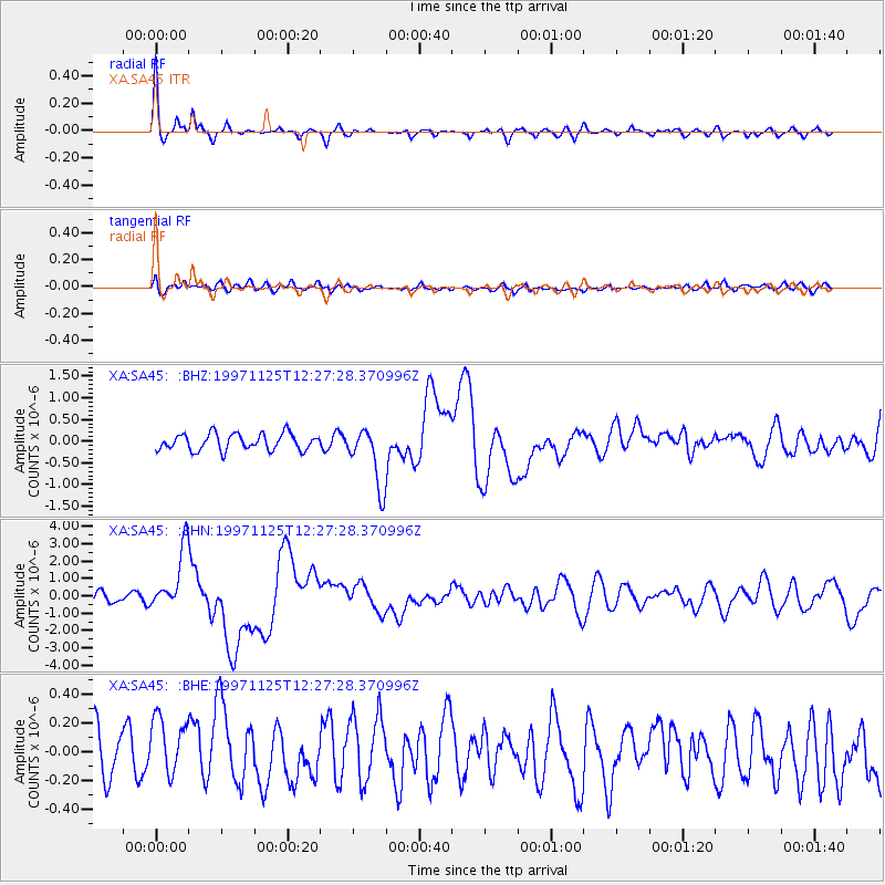
| XA:SA45: :BHN:19971125T12:27:28.370996Z | 6.2387295 | 1.7616561E-6 | 2.8237417E-7 |
| XA:SA45: :BHE:19971125T12:27:28.370996Z | 1.4611292 | 2.4217078E-7 | 1.6574221E-7 |
| XA:SA45: :BHZ:19971125T12:27:28.370996Z | 3.6131706 | 6.890384E-7 | 1.9070188E-7 |
| Arrivals | |
| Ps | 5.7 SECOND |
| PpPs | 20 SECOND |
| PsPs/PpSs | 26 SECOND |

