You are here: Home > Network List > US - United States National Seismic Network Stations List
> Station WMOK Wichita Mountains, Oklahoma, USA > Earthquake Result Viewer
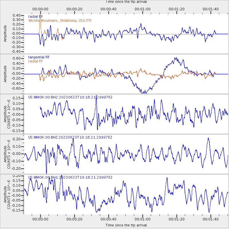
WMOK Wichita Mountains, Oklahoma, USA - Earthquake Result Viewer
*The percent match for this event was below the threshold and hence no stack was calculated.
| Earthquake location: |
Tonga Islands |
| Earthquake latitude/longitude: |
-15.2/-173.0 |
| Earthquake time(UTC): |
2023/06/23 (174) 19:06:11 GMT |
| Earthquake Depth: |
10 km |
| Earthquake Magnitude: |
5.6 Mww |
| Earthquake Catalog/Contributor: |
NEIC PDE/us |
|
| Network: |
US United States National Seismic Network |
| Station: |
WMOK Wichita Mountains, Oklahoma, USA |
| Lat/Lon: |
34.74 N/98.78 W |
| Elevation: |
486 m |
|
| Distance: |
86.1 deg |
| Az: |
52.597 deg |
| Baz: |
248.612 deg |
| Ray Param: |
$rayparam |
*The percent match for this event was below the threshold and hence was not used in the summary stack. |
|
| Radial Match: |
54.30627 % |
| Radial Bump: |
400 |
| Transverse Match: |
47.88973 % |
| Transverse Bump: |
400 |
| SOD ConfigId: |
30536071 |
| Insert Time: |
2023-07-07 19:31:15.162 +0000 |
| GWidth: |
2.5 |
| Max Bumps: |
400 |
| Tol: |
0.001 |
|
Signal To Noise
| Channel | StoN | STA | LTA |
| US:WMOK:00:BHZ:20230623T19:18:21.299976Z | 1.4468833 | 8.224171E-8 | 5.6840598E-8 |
| US:WMOK:00:BH1:20230623T19:18:21.299976Z | 1.331213 | 1.7367873E-7 | 1.3046653E-7 |
| US:WMOK:00:BH2:20230623T19:18:21.299976Z | 2.1447241 | 9.553681E-8 | 4.4545033E-8 |
| Arrivals |
| Ps | |
| PpPs | |
| PsPs/PpSs | |


