You are here: Home > Network List > TA - USArray Transportable Network (new EarthScope stations) Stations List
> Station H26A Fairpoint, SD, USA > Earthquake Result Viewer
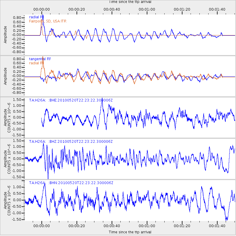
H26A Fairpoint, SD, USA - Earthquake Result Viewer
*The percent match for this event was below the threshold and hence no stack was calculated.
| Earthquake location: |
Costa Rica |
| Earthquake latitude/longitude: |
9.2/-84.3 |
| Earthquake time(UTC): |
2010/05/20 (140) 22:16:30 GMT |
| Earthquake Depth: |
21 km |
| Earthquake Magnitude: |
5.6 MB, 5.6 MS, 5.9 MW, 5.9 MW |
| Earthquake Catalog/Contributor: |
WHDF/NEIC |
|
| Network: |
TA USArray Transportable Network (new EarthScope stations) |
| Station: |
H26A Fairpoint, SD, USA |
| Lat/Lon: |
44.62 N/102.77 W |
| Elevation: |
879 m |
|
| Distance: |
38.7 deg |
| Az: |
338.782 deg |
| Baz: |
149.983 deg |
| Ray Param: |
$rayparam |
*The percent match for this event was below the threshold and hence was not used in the summary stack. |
|
| Radial Match: |
71.64607 % |
| Radial Bump: |
400 |
| Transverse Match: |
51.42208 % |
| Transverse Bump: |
400 |
| SOD ConfigId: |
314592 |
| Insert Time: |
2010-09-04 08:35:00.101 +0000 |
| GWidth: |
2.5 |
| Max Bumps: |
400 |
| Tol: |
0.001 |
|
Signal To Noise
| Channel | StoN | STA | LTA |
| TA:H26A: :BHZ:20100520T22:23:22.300006Z | 5.7367725 | 7.3111585E-7 | 1.2744376E-7 |
| TA:H26A: :BHN:20100520T22:23:22.300006Z | 2.4100466 | 7.3728506E-7 | 3.059215E-7 |
| TA:H26A: :BHE:20100520T22:23:22.300006Z | 2.2558563 | 7.005454E-7 | 3.1054523E-7 |
| Arrivals |
| Ps | |
| PpPs | |
| PsPs/PpSs | |


