You are here: Home > Network List > TA - USArray Transportable Network (new EarthScope stations) Stations List
> Station F27A Lemmon, SD, USA > Earthquake Result Viewer
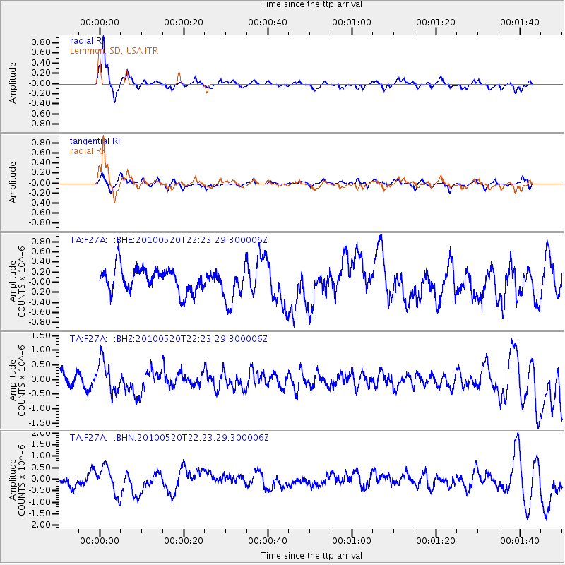
F27A Lemmon, SD, USA - Earthquake Result Viewer

| Earthquake location: |
Costa Rica |
| Earthquake latitude/longitude: |
9.2/-84.3 |
| Earthquake time(UTC): |
2010/05/20 (140) 22:16:30 GMT |
| Earthquake Depth: |
21 km |
| Earthquake Magnitude: |
5.6 MB, 5.6 MS, 5.9 MW, 5.9 MW |
| Earthquake Catalog/Contributor: |
WHDF/NEIC |
|
| Network: |
TA USArray Transportable Network (new EarthScope stations) |
| Station: |
F27A Lemmon, SD, USA |
| Lat/Lon: |
45.87 N/102.02 W |
| Elevation: |
757 m |
|
| Distance: |
39.5 deg |
| Az: |
340.488 deg |
| Baz: |
151.84 deg |
| Ray Param: |
0.0748983 |
| Estimated Moho Depth: |
19.75 km |
| Estimated Crust Vp/Vs: |
1.60 |
| Assumed Crust Vp: |
6.242 km/s |
| Estimated Crust Vs: |
3.901 km/s |
| Estimated Crust Poisson's Ratio: |
0.18 |
|
| Radial Match: |
81.21235 % |
| Radial Bump: |
259 |
| Transverse Match: |
42.333355 % |
| Transverse Bump: |
362 |
| SOD ConfigId: |
314592 |
| Insert Time: |
2010-09-04 08:35:35.912 +0000 |
| GWidth: |
2.5 |
| Max Bumps: |
400 |
| Tol: |
0.001 |
|
Signal To Noise
| Channel | StoN | STA | LTA |
| TA:F27A: :BHZ:20100520T22:23:29.300006Z | 2.969501 | 5.3622836E-7 | 1.8057861E-7 |
| TA:F27A: :BHN:20100520T22:23:29.300006Z | 2.0876558 | 5.9029026E-7 | 2.8275267E-7 |
| TA:F27A: :BHE:20100520T22:23:29.300006Z | 1.5709796 | 3.7363836E-7 | 2.3783781E-7 |
| Arrivals |
| Ps | 2.0 SECOND |
| PpPs | 7.6 SECOND |
| PsPs/PpSs | 9.7 SECOND |


