You are here: Home > Network List > CN - Canadian National Seismograph Network Stations List
> Station INK INUVIK, NT > Earthquake Result Viewer
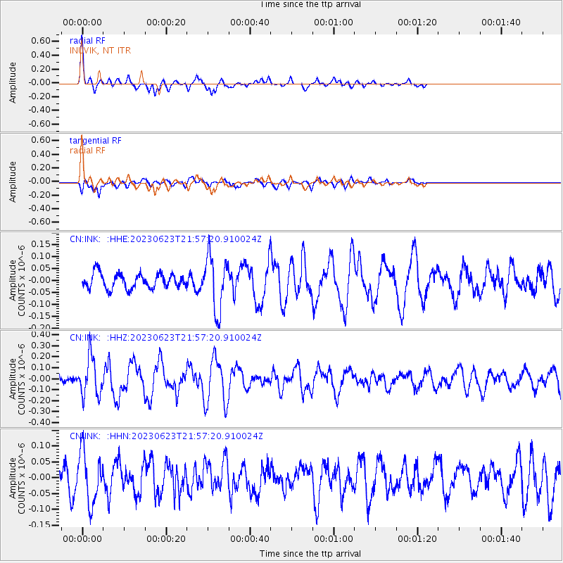
INK INUVIK, NT - Earthquake Result Viewer
*The percent match for this event was below the threshold and hence no stack was calculated.
| Earthquake location: |
Northern Mid-Atlantic Ridge |
| Earthquake latitude/longitude: |
44.9/-28.1 |
| Earthquake time(UTC): |
2023/06/23 (174) 21:48:25 GMT |
| Earthquake Depth: |
10 km |
| Earthquake Magnitude: |
5.6 Mww |
| Earthquake Catalog/Contributor: |
NEIC PDE/us |
|
| Network: |
CN Canadian National Seismograph Network |
| Station: |
INK INUVIK, NT |
| Lat/Lon: |
68.31 N/133.53 W |
| Elevation: |
44 m |
|
| Distance: |
54.3 deg |
| Az: |
333.823 deg |
| Baz: |
57.433 deg |
| Ray Param: |
$rayparam |
*The percent match for this event was below the threshold and hence was not used in the summary stack. |
|
| Radial Match: |
74.37271 % |
| Radial Bump: |
303 |
| Transverse Match: |
69.40885 % |
| Transverse Bump: |
400 |
| SOD ConfigId: |
30536071 |
| Insert Time: |
2023-07-07 22:01:46.070 +0000 |
| GWidth: |
2.5 |
| Max Bumps: |
400 |
| Tol: |
0.001 |
|
Signal To Noise
| Channel | StoN | STA | LTA |
| CN:INK: :HHZ:20230623T21:57:20.910024Z | 4.2817802 | 1.811898E-7 | 4.231647E-8 |
| CN:INK: :HHN:20230623T21:57:20.910024Z | 2.2969928 | 8.298477E-8 | 3.612757E-8 |
| CN:INK: :HHE:20230623T21:57:20.910024Z | 3.666743 | 1.15302846E-7 | 3.1445573E-8 |
| Arrivals |
| Ps | |
| PpPs | |
| PsPs/PpSs | |


