You are here: Home > Network List > US - United States National Seismic Network Stations List
> Station DGMT Dagmar, Montana, USA > Earthquake Result Viewer
DGMT Dagmar, Montana, USA - Earthquake Result Viewer
*The percent match for this event was below the threshold and hence no stack was calculated.
| Earthquake location: |
Costa Rica |
| Earthquake latitude/longitude: |
9.2/-84.3 |
| Earthquake time(UTC): |
2010/05/20 (140) 22:16:30 GMT |
| Earthquake Depth: |
21 km |
| Earthquake Magnitude: |
5.6 MB, 5.6 MS, 5.9 MW, 5.9 MW |
| Earthquake Catalog/Contributor: |
WHDF/NEIC |
|
| Network: |
US United States National Seismic Network |
| Station: |
DGMT Dagmar, Montana, USA |
| Lat/Lon: |
48.47 N/104.20 W |
| Elevation: |
0.0 m |
|
| Distance: |
42.5 deg |
| Az: |
340.428 deg |
| Baz: |
150.204 deg |
| Ray Param: |
$rayparam |
*The percent match for this event was below the threshold and hence was not used in the summary stack. |
|
| Radial Match: |
40.46504 % |
| Radial Bump: |
344 |
| Transverse Match: |
52.720863 % |
| Transverse Bump: |
400 |
| SOD ConfigId: |
314592 |
| Insert Time: |
2010-09-04 08:42:52.638 +0000 |
| GWidth: |
2.5 |
| Max Bumps: |
400 |
| Tol: |
0.001 |
|
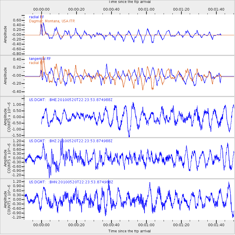
Signal To Noise
| Channel | StoN | STA | LTA |
| US:DGMT: :BHZ:20100520T22:23:53.874988Z | 3.5407493 | 5.508381E-7 | 1.5557106E-7 |
| US:DGMT: :BHN:20100520T22:23:53.874988Z | 1.743125 | 4.841954E-7 | 2.7777438E-7 |
| US:DGMT: :BHE:20100520T22:23:53.874988Z | 0.946001 | 3.0374338E-7 | 3.2108147E-7 |
| Arrivals |
| Ps | |
| PpPs | |
| PsPs/PpSs | |


